Lapanouse
| Lapanouse | |
|---|---|
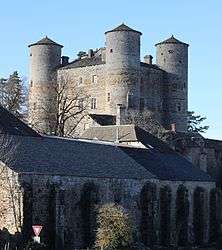 The Château of Loupiac | |
 Lapanouse Location within Occitanie region  Lapanouse | |
| Coordinates: 44°20′12″N 3°01′57″E / 44.3367°N 3.0325°ECoordinates: 44°20′12″N 3°01′57″E / 44.3367°N 3.0325°E | |
| Country | France |
| Region | Occitanie |
| Department | Aveyron |
| Arrondissement | Millau |
| Canton | Tarn et Causses |
| Government | |
| • Mayor (2008–2014) | Alain Gal |
| Area1 | 27.19 km2 (10.50 sq mi) |
| Population (2008)2 | 750 |
| • Density | 28/km2 (71/sq mi) |
| Time zone | UTC+1 (CET) |
| • Summer (DST) | UTC+2 (CEST) |
| INSEE/Postal code | 12123 /12150 |
| Elevation |
630–923 m (2,067–3,028 ft) (avg. 650 m or 2,130 ft) |
|
1 French Land Register data, which excludes lakes, ponds, glaciers > 1 km2 (0.386 sq mi or 247 acres) and river estuaries. 2 Population without double counting: residents of multiple communes (e.g., students and military personnel) only counted once. | |
Lapanouse is a former commune in the Aveyron department in southern France. On 1 January 2016, it was merged into the new commune of Sévérac-d'Aveyron.[1]
Population
| Historical population | ||
|---|---|---|
| Year | Pop. | ±% |
| 1962 | 478 | — |
| 1968 | 517 | +8.2% |
| 1975 | 577 | +11.6% |
| 1982 | 663 | +14.9% |
| 1990 | 709 | +6.9% |
| 1999 | 692 | −2.4% |
| 2008 | 750 | +8.4% |
See also
References
- ↑ Arrêté préfectoral 6 November 2015
External links

| Authority control |
|---|
This article is issued from
Wikipedia.
The text is licensed under Creative Commons - Attribution - Sharealike.
Additional terms may apply for the media files.