Langthorne
| Langthorne | |
|---|---|
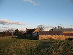 West Farm, by Langthorne | |
 Langthorne Langthorne shown within North Yorkshire | |
| OS grid reference | SE251915 |
| District | |
| Shire county | |
| Region | |
| Country | England |
| Sovereign state | United Kingdom |
| Post town | Bedale |
| Postcode district | DL8 |
| Police | North Yorkshire |
| Fire | North Yorkshire |
| Ambulance | Yorkshire |
| EU Parliament | Yorkshire and the Humber |
Langthorne is a village and civil parish in Hambleton district of North Yorkshire, England.[1] Like many settlements in the area during the tine of the Domesday Book, the land belonged to Count Alan and had just three villagers registered as living there.[2] The name of the village means Tall Thorn-Bush (or tree) and derives from the Old English Lang and þorn.[3]
The population as taken at the 2011 Census was less than 100 and estimated to be 60 in 2015.[4] Details are included in the civil parish of Patrick Brompton. It is near Hackforth and the A1(M) motorway 2 miles (3.2 km) north of Bedale.
References
- ↑ Ordnance Survey: Landranger map sheet 99 Northallerton & Ripon (Pateley Bridge & Leyburn) (Map). Ordnance Survey. 2013. ISBN 9780319231593.
- ↑ Powell-Smith, Anna. "Langthorne | Domesday Book". opendomesday.org. Retrieved 17 March 2018.
- ↑ Ekwall, Eilert (1960). The concise Oxford dictionary of English place-names (4 ed.). Oxford: Clarendon Press. p. 287. ISBN 0-19-869103-3.
- ↑ "2015 Population Estimates" (PDF). northyorks.gov.uk. p. 11. Retrieved 17 March 2018.
This article is issued from
Wikipedia.
The text is licensed under Creative Commons - Attribution - Sharealike.
Additional terms may apply for the media files.