Langbaurgh Ridge
| Langbaurgh Ridge | |
| Site of Special Scientific Interest | |
 | |
| Country | England |
|---|---|
| Region | North East |
| Unitary Authority and non-metropolitan district |
Redcar and Cleveland and Hambleton |
| Location | Great Ayton |
| - coordinates | 54°30′5″N 1°8′4″W / 54.50139°N 1.13444°WCoordinates: 54°30′5″N 1°8′4″W / 54.50139°N 1.13444°W |
| Area | 7.0 ha (17.3 acres) |
| Notification | 1986 |
| Management | Natural England |
| Areas of Search | Cleveland, North Yorkshire |
| Interest | Geological |
 Location in the UK | |
| Website: Map of site | |
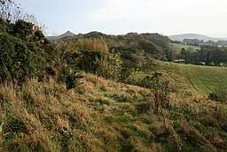
Langbaurgh Ridge (grid reference NZ560121) is a 8.0 hectare[1] geological Site of Special Scientific Interest near the hamlet of Langbaurgh in North Yorkshire, England, notified in 1986.[2] The site crossed the former county boundary of Cleveland and North Yorkshire.
The site is identified as being of national importance in the Geological Conservation Review.
| Wikimedia Commons has media related to Langbaurgh Ridge. |
References
- ↑ "Langbaurgh Ridge | Protected Planet". www.protectedplanet.net. Retrieved 2016-03-22.
- ↑ "Langbaurgh Ridge | Protected Planet". www.protectedplanet.net. Retrieved 2016-03-22.
Sources
- English Nature citation sheet for the site (accessed 5 August 2006)
External links
This article is issued from
Wikipedia.
The text is licensed under Creative Commons - Attribution - Sharealike.
Additional terms may apply for the media files.