Lang, Saskatchewan
| Lang | ||
|---|---|---|
| Village | ||
| Village of Lang | ||
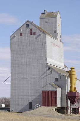 Grain elevator in Lang | ||
| ||
 Lang in Saskatchewan  Lang, Saskatchewan (Canada) | ||
| Coordinates: 49°55′07″N 104°22′22″W / 49.91853°N 104.37282°W | ||
| Country |
| |
| Province |
| |
| Region | Southeast | |
| Census division | 2 | |
| Rural Municipality | Scott No. 98 | |
| Post office founded | May 15, 1904 | |
| Government | ||
| • Type | Municipal | |
| • Governing body | Lang Village Council[1] | |
| • Mayor | Allan Broderick | |
| • Administrator | Darlene Wingert | |
| Area | ||
| • Total | 0.64 km2 (0.25 sq mi) | |
| Population (2016) | ||
| • Total | 189 | |
| • Density | 293.8/km2 (761/sq mi) | |
| Time zone | UTC-6 (CST) | |
| Postal code | S0G 2W0 | |
| Area code(s) | 306 | |
| Highways |
| |
| Website | Village of Lang | |
| [2][3][4][5] | ||

Lang is a village within the Rural Municipality of Scott No. 98, in the province of Saskatchewan, Canada. The village is located approximately 70 km south east of the capital, Regina. Lang had a population of 189 in the 2016 Canada Census (a 5.5% decrease from 200 in the 2011 Canada Census).
Demographics
| Canada census – Lang, Saskatchewan community profile | |||
|---|---|---|---|
| 2016 | 2011 | 2006 | |
| Population: | 189 (-5.5% from 2011) | 200 (16.3% from 2006) | 172 (-9.0% from 2001) |
| Land area: | 0.64 km2 (0.25 sq mi) | 0.64 km2 (0.25 sq mi) | 0.64 km2 (0.25 sq mi) |
| Population density: | 293.9/km2 (761/sq mi) | 311.0/km2 (805/sq mi) | 267.5/km2 (693/sq mi) |
| Median age: | 38.9 (M: 40.2, F: 38.2) | 40.5 (M: 38.8, F: 43.5) | 44.4 (M: 45.0, F: 46.0) |
| Total private dwellings: | 96 | 92 | 85 |
| Median household income: | $67,840 | ||
| References: 2016[6] 2011[7] 2006[8] earlier[9] | |||
Education
Students from Lang attend school in Milestone, of the Prairie Valley School Division.[10]
See also
Footnotes
- ↑ Lang Village Council
- ↑ National Archives, Archivia Net, Post Offices and Postmasters, archived from the original on 2006-10-06
- ↑ Government of Saskatchewan, MRD Home, Municipal Directory System, archived from the original on November 21, 2008
- ↑ Canadian Textiles Institute. (2005), CTI Determine your provincial constituency, archived from the original on 2007-09-11
- ↑ Commissioner of Canada Elections, Chief Electoral Officer of Canada (2005), Elections Canada On-line, archived from the original on 2007-04-21
- ↑ "2016 Community Profiles". Canada 2016 Census. Statistics Canada. February 21, 2017. Retrieved 2017-03-15.
- ↑ "2011 Community Profiles". Canada 2011 Census. Statistics Canada. July 5, 2013. Retrieved 2012-10-14.
- ↑ "2006 Community Profiles". Canada 2006 Census. Statistics Canada. March 30, 2011. Retrieved 2011-02-20.
- ↑ "2001 Community Profiles". Canada 2001 Census. Statistics Canada. February 17, 2012.
- ↑ Prairie Valley School Division
External links
- Village of Lang
- Saskatchewan City & Town Maps
- Saskatchewan Gen Web - One Room School Project
- Post Offices and Postmasters - ArchiviaNet - Library and Archives Canada
- Saskatchewan Gen Web Region
- Online Historical Map Digitization Project
- GeoNames Query
- 2006 Community Profiles
Places adjacent to Lang, Saskatchewan | ||||||||||
|---|---|---|---|---|---|---|---|---|---|---|
| ||||||||||
| Subdivisions | |
|---|---|
| Communities | |
| Cities | |
| Topics |
|
| |

Coordinates: 49°55′08″N 104°22′19″W / 49.919°N 104.372°W
This article is issued from
Wikipedia.
The text is licensed under Creative Commons - Attribution - Sharealike.
Additional terms may apply for the media files.