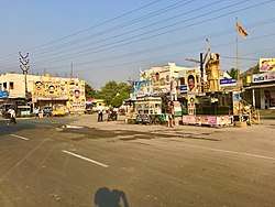
Lam, Guntur district
| Lam | |
|---|---|
| Village | |
 Lam Village | |
 Lam Location in Andhra Pradesh, India  Lam Lam (India) | |
| Coordinates: 16°13′33″N 80°15′50″E / 16.2257°N 80.2640°ECoordinates: 16°13′33″N 80°15′50″E / 16.2257°N 80.2640°E | |
| Country | India |
| State | Andhra Pradesh |
| District | Guntur |
| Mandal | Tadikonda mandal |
| Area[1] | |
| • Total | 12.08 km2 (4.66 sq mi) |
| Elevation | 12 m (39 ft) |
| Population (2011)[1] | |
| • Total | 6,552 |
| • Density | 540/km2 (1,400/sq mi) |
| Languages | |
| • Official | Telugu |
| Time zone | UTC+05:30 (IST) |
Lam is a village in Guntur district of the Indian state of Andhra Pradesh. It is located in Tadikonda mandal of Guntur revenue division.[1][2]
Etymology
The name originated from Lamas, a Buddhist monk.[3]
Demographics
As of 2011 census, Lam has a population of 6552, of which males are 3207 and females are 3345 with a sex ratio 1043, Child account a population of 762 with 11.63% of total population with a sex ratio of 1117. Literacy rate in Lam is 64.04%.
Education
Agricultural University and Regional Agricultural Research Station are the major educational and research establishments in the village. Regional Agricultural Research Station was set up in 1922.[3]
See also
References
- 1 2 3 "District Census Handbook - Guntur" (PDF). Census of India. p. 14,276. Retrieved 29 December 2015.
- ↑ "District Level Mandal wise List of Villages in Andhra Pradesh" (PDF). Chief Commissioner of Land Administration. National Informatics Centre. p. 1. Archived from the original (PDF) on 10 December 2014. Retrieved 12 January 2016.
- 1 2 "Guntur hogs limelight, bags two Central institutes". The Hindu. 21 December 2015. Retrieved 25 June 2016.
This article is issued from
Wikipedia.
The text is licensed under Creative Commons - Attribution - Sharealike.
Additional terms may apply for the media files.