Lakeshore, Louisiana
| Lakeshore, Louisiana | |
|---|---|
| Unincorporated community | |
 Lakeshore, Louisiana  Lakeshore, Louisiana | |
| Coordinates: 32°32′07″N 92°01′46″W / 32.53528°N 92.02944°WCoordinates: 32°32′07″N 92°01′46″W / 32.53528°N 92.02944°W | |
| Country | United States |
| State | Louisiana |
| Parish | Ouachita |
| Area[1] | |
| • Total | 0.944 sq mi (2.44 km2) |
| • Land | 0.853 sq mi (2.21 km2) |
| • Water | 0.091 sq mi (0.24 km2) |
| Elevation | 79 ft (24 m) |
| Population (2010)[1] | |
| • Total | 1,930 |
| • Density | 2,000/sq mi (790/km2) |
| Time zone | UTC-6 (Central (CST)) |
| • Summer (DST) | UTC-5 (CDT) |
| Area code(s) | 318 |
| GNIS feature ID | 548429[2] |
Lakeshore is an unincorporated community and census-designated place in Ouachita Parish, Louisiana, United States. Its population was 1,930 as of the 2010 census.[1] The community is located on the south bank of the Ouachita River, east of Monroe.
Geography
According to the U.S. Census Bureau, the community has an area of 0.944 square miles (2.44 km2); 0.853 square miles (2.21 km2) of its area is land, and 0.091 square miles (0.24 km2) is water.[1]
References
- 1 2 3 4 "2010 Census Gazetteer Files - Places: Louisiana". U.S. Census Bureau. Retrieved January 14, 2017.
- ↑ "Lakeshore". Geographic Names Information System. United States Geological Survey.
Municipalities and communities of Ouachita Parish, Louisiana, United States | ||
|---|---|---|
| Cities | 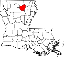 | |
| Towns | ||
| CDPs | ||
| Unincorporated communities | ||
This article is issued from
Wikipedia.
The text is licensed under Creative Commons - Attribution - Sharealike.
Additional terms may apply for the media files.