Lake Rerewhakaaitu
| Lake Rerewhakaaitu | |
|---|---|
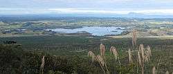 View of the lake from Mount Tarawera | |
| Location | North Island |
| Coordinates | 38°18′S 176°30′E / 38.300°S 176.500°ECoordinates: 38°18′S 176°30′E / 38.300°S 176.500°E |
| Basin countries | New Zealand |
| Max. length | 3.8 km (2.4 mi)[1] |
| Max. width | 3.7 km (2.3 mi)[1] |
| Surface area | 8 km2 (3.1 sq mi)[1] |
| Average depth | 6 m (20 ft)[1] |
| Max. depth | 15 m (49 ft)[1] |
| Surface elevation | 438 m (1,437 ft)[1] |
| References | [1] |
Lake Rerewhakaaitu is a small, shallow lake in northern New Zealand, located 30 kilometres to the east of Rotorua. It is immediately south of the active volcano Mount Tarawera, and the geography was substantially altered by a major eruption in 1886.
References
This article is issued from
Wikipedia.
The text is licensed under Creative Commons - Attribution - Sharealike.
Additional terms may apply for the media files.