Lake Medina Shores, Texas
| Lake Medina Shores, Texas | |
|---|---|
| Census-designated place | |
 Lake Medina Shores | |
| Coordinates: 29°38′17″N 98°59′29″W / 29.63806°N 98.99139°WCoordinates: 29°38′17″N 98°59′29″W / 29.63806°N 98.99139°W | |
| Country | United States |
| State | Texas |
| Counties | Bandera, Medina |
| Area | |
| • Total | 3.4 sq mi (9 km2) |
| • Land | 3.1 sq mi (8 km2) |
| • Water | 0.3 sq mi (0.8 km2) |
| Elevation | 1,145 ft (349 m) |
| Population (2010)[1] | |
| • Total | 1,235 |
| • Density | 360/sq mi (140/km2) |
| Time zone | UTC-6 (Central (CST)) |
| • Summer (DST) | UTC-5 (CDT) |
| Zip Code | 78003 |
| Area code(s) | 830 |
| FIPS code | 48-40674 |
| GNIS feature ID | 2586547[2] |
Lake Medina Shores is a census-designated place in Bandera and Medina counties, Texas, United States. Its population was 1,235 as of the 2010 census.[1] This was a new CDP for the 2010 census.[3]
Geography
Lake Medina Shores is located at 29°38′17″N 98°59′19″W / 29.63806°N 98.98861°W (29.637992, -98.991496). According to the United States Census Bureau, the CDP has a total area of 3.4 square miles (8.8 km2), of which, 3.1 square miles (8.0 km2) of it is land and 0.3 square miles (0.78 km2) is water.[4]
References
- 1 2 "American FactFinder". United States Census Bureau. Retrieved 2011-05-14.
- ↑ "Lake Medina Shores Census Designated Place". Geographic Names Information System. United States Geological Survey.
- ↑ "Population and Housing Unit Counts, 2010 Census of Population and Housing" (PDF). Texas: 2010. Retrieved 12 January 2017.
- ↑ "US Gazetteer Files 2016-Places-Texas". US Census. Retrieved 12 January 2017.
Municipalities and communities of Bandera County, Texas, United States | ||
|---|---|---|
| City | 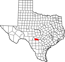 | |
| CDPs | ||
| Unincorporated communities | ||
| Footnotes | ‡This city also has portions in an adjacent county or counties | |
Municipalities and communities of Medina County, Texas, United States | ||
|---|---|---|
| Cities | 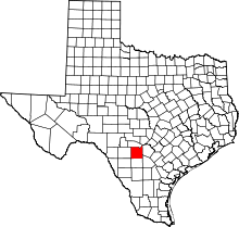 | |
| CDPs | ||
| Other unincorporated communities | ||
| Ghost Towns |
| |
| Footnotes | ‡This city also has portions in an adjacent county or counties | |
This article is issued from
Wikipedia.
The text is licensed under Creative Commons - Attribution - Sharealike.
Additional terms may apply for the media files.