Lajitas, Texas
| Lajitas, Texas | |
|---|---|
| Unincorporated community | |
.jpg) Lajitas in 2014 | |
 Lajitas, Texas Location within Texas | |
| Coordinates: 29°15′42″N 103°46′36″W / 29.26167°N 103.77667°WCoordinates: 29°15′42″N 103°46′36″W / 29.26167°N 103.77667°W | |
| Country | United States |
| State | Texas |
| County | Brewster |
| Elevation | 2,342 ft (714 m) |
| Time zone | UTC-6 (Central (CST)) |
| • Summer (DST) | UTC-5 (CDT) |
| ZIP codes | 79852 |
| Area code | 432 |
| GNIS feature ID | 1339481 |
Lajitas is an unincorporated community in Brewster County, Texas, United States, in proximity to the Big Bend National Park.
History
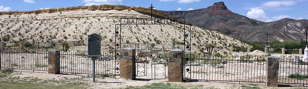
The settlement is named for the Boquillas flagstone found in the area. "Lajitas" translates to "little flat rocks" in Spanish.[1]
Geography
Climate
Lajitas has a hot semi-arid climate with very hot summers and mild winters.
| Climate data for Lajitas, Texas (Mar 1, 1978–Mar 31, 2013) | |||||||||||||
|---|---|---|---|---|---|---|---|---|---|---|---|---|---|
| Month | Jan | Feb | Mar | Apr | May | Jun | Jul | Aug | Sep | Oct | Nov | Dec | Year |
| Record high °F (°C) | 89 (32) |
98 (37) |
102 (39) |
109 (43) |
113 (45) |
115 (46) |
113 (45) |
112 (44) |
110 (43) |
104 (40) |
97 (36) |
90 (32) |
115 (46) |
| Average high °F (°C) | 68.8 (20.4) |
75.0 (23.9) |
83.1 (28.4) |
91.2 (32.9) |
97.8 (36.6) |
102.2 (39) |
100.5 (38.1) |
99.1 (37.3) |
95.1 (35.1) |
87.8 (31) |
77.4 (25.2) |
69.2 (20.7) |
87.3 (30.7) |
| Daily mean °F (°C) | 51.7 (10.9) |
57.1 (13.9) |
64.5 (18.1) |
72.7 (22.6) |
80.8 (27.1) |
87.6 (30.9) |
87.3 (30.7) |
86.0 (30) |
81.5 (27.5) |
72.0 (22.2) |
60.5 (15.8) |
52.2 (11.2) |
71.2 (21.8) |
| Average low °F (°C) | 34.6 (1.4) |
39.1 (3.9) |
45.8 (7.7) |
54.3 (12.4) |
63.8 (17.7) |
73.0 (22.8) |
74.1 (23.4) |
72.9 (22.7) |
67.6 (19.8) |
56.3 (13.5) |
43.6 (6.4) |
35.2 (1.8) |
55.0 (12.8) |
| Record low °F (°C) | 14 (−10) |
5 (−15) |
19 (−7) |
28 (−2) |
42 (6) |
59 (15) |
54 (12) |
61 (16) |
47 (8) |
27 (−3) |
23 (−5) |
10 (−12) |
5 (−15) |
| Average precipitation inches (mm) | 0.33 (8.4) |
0.27 (6.9) |
0.23 (5.8) |
0.34 (8.6) |
0.95 (24.1) |
1.47 (37.3) |
2.16 (54.9) |
1.32 (33.5) |
1.57 (39.9) |
1.29 (32.8) |
0.30 (7.6) |
0.24 (6.1) |
10.47 (265.9) |
| Average snowfall inches (cm) | 0.0 (0) |
0.0 (0) |
0.0 (0) |
0.0 (0) |
0.0 (0) |
0.0 (0) |
0.0 (0) |
0.0 (0) |
0.0 (0) |
0.0 (0) |
0.0 (0) |
0.0 (0) |
0.1 (0.3) |
| Average precipitation days (≥ 0.001 in) | 2.17 | 1.43 | 1.14 | 1.51 | 3.22 | 4.17 | 5.78 | 4.47 | 4.35 | 3.56 | 1.85 | 1.50 | 33.79 |
| Source: Western Regional Climate Center, Desert Research Institute[2] | |||||||||||||
Economy
The Lajitas Golf Resort and Spa is a 20,000-acre golf resort business in Lajitas owned by Texas businessman Kelcy Warren, who bought the resort from previous owner Steve Smith while the business was going through financial distress.[3] It is located on the Rio Grande river, bordering Mexico,[4] between Big Bend National Park and Big Bend Ranch State Park.[5]
Government
For many years the mayor of Lajitas was Clay Henry III, a "beer-drinking" goat.[6] After two replacements of the original Clay Henry, the trading post and stable where the mayor lived is now closed and the goat no longer resides there.[7][8]
Education
Lajitas is zoned to schools in the Terlingua Common School District.
Infrastructure
Airport
Due to the remoteness of the resort, Lajitas is serviced by the Lajitas International Airport, a private airport with a 5,000 ft (1,500 m) asphalt runway.[4]
In popular culture
Lajitas is mentioned extensively in Red Dirt/Texas Country artist Wade Bowen's song "Day of the Dead" recorded in October 2017.
References
- ↑ "Old Cemetery In Lajitas, Texas, A Tiny Town That Abuts Big Bend National Park In Southwestern Brewster County, On A Bluff Overlooking The Rio Grande River In The Northern Part Of The Chihuahuan Desert". Library of Congress. Retrieved August 22, 2018.
- ↑ "LAJITAS, TEXAS (414950), Period of Record Monthly Climate Summary". Western Regional Climate Center, Desert Research Institute. Retrieved May 6, 2015.
- ↑ Fenton, Tom (2015-09-14). "Lajitas Resort: Why you better go now - El Paso Inc.: Publishers Column". El Paso Inc. Retrieved 2017-04-04.
- 1 2 Black Jack's Crossing Golf Club, Bradley S. Klein, Business Jet Traveler, August 2012.
- ↑ Texas: Bordering on the bizarre, by Russell Baillie, New Zealand Herald, 5:00 PM Thursday Mar 16, 2017.
- ↑ Cannon, B. (2004). Texas: Land of Legend and Lore. Wordware Publishing, Incorporated. p. 204. ISBN 978-1-55622-949-7.
- ↑ "Mayor Clay Henry III: A Word About the Mayor". Lajitas Resort & Spa. Archived from the original on 7 May 2009. Retrieved 12 June 2012.
- ↑ RoadsideAmerica.com staff (May 2011). "Clay Henry - Famous Beer-Drinking Dead Goat". RoadsideAmerica.com. Retrieved 12 June 2012.
Further reading
- Hilton, Evelyn. "Lajitas, TX". TSHA Handbook of Texas Online. Texas State Historical Association.
External links
Municipalities and communities of Brewster County, Texas, United States | ||
|---|---|---|
| City | 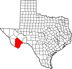 | |
| CDPs | ||
| Other unincorporated communities | ||
| Ghost Towns | ||
| Annexed former counties | ||