Lagamar Mosaic
| Lagamar Mosaic | |
|---|---|
| Mosaico do Lagamar | |
 | |
| Coordinates | 25°01′08″S 48°01′37″W / 25.019°S 48.027°WCoordinates: 25°01′08″S 48°01′37″W / 25.019°S 48.027°W |
| Designation | Protected area mosaic |
| Administrator | ICMBio |
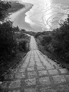
The Lagamar Mosaic (Portuguese: Mosaico do Lagamar is a protected area mosaic that includes a number of conservation units in the states of São Paulo and Paraná, Brazil.
History
The Lagamar Mosaic was established by federal ordinance 150 of 8 May 2006. The project was supported by the "Mangroves of Brazil" project as a way of leveraging joint action among the municipal, state and federal mangrove conservation units.[1] In 2009 about 40% of the area was included as a pilot area of the "Mangroves of Brazil" project. The mosaic council was formed in October 2013, and included representatives of various government and civil society organisations.[1]
Scope and purpose
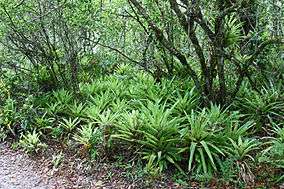
The mosaic includes strategic areas for conservation of the remaining mangroves of the south and southeast coasts of Brazil. Great effort is needed to preserve these areas, and also to preserve the traditional knowledge of the local population that depend on products of the native species.[1] As of June 2014 there were 52 conservation units in the mosaic, forming the largest continuous remnant of Atlantic forest in Brazil. A mosaic is defined as a set of protected areas, of the same or different categories, adjacent or nearby, and other public or private protected areas, that are managed in a joint or integrated manner. The conservation units are made more effective by coordinating their activities.[2]
Conservation units
The Lagamar Mosaic contains the following units:[3]
Notes
- ↑ On 21 February 2008 the Jacupiranga State Park was dissolved and replaced by the much larger Jacupiranga Mosaic, containing three state parks and 11 other conservation units.[4]
Sources
- Instalada Gestao Integrada do Mosaico Lagamar (in Portuguese), ISA: Instituto Socioambiental, 20 December 2013, retrieved 2016-09-19
- Mosaico Lagamar: você sabe o que é? (in Portuguese), SPVS, 20 June 2014, retrieved 2016-09-19
- Unidades de Conservação - Mosaico do Litoral Sul de São Paulo e do Litoral do Paraná - LAGAMAR (in Portuguese), ICMBio, retrieved 2016-09-19
- Zanchetta, Inês; Bedeschi, Luciana (28 February 2008), Mosaico do Jacupiranga, no Vale do Ribeira, agora é lei (in Portuguese), ISA: Instituto Socioambiental, retrieved 2016-11-20