Ladd Glacier
| Ladd Glacier | |
|---|---|
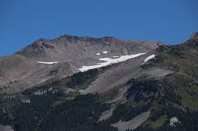 A portion of Ladd Glacier is visible below Barrett Spur, 7,863 feet (2,397 m). Barrett Spur separates Ladd Glacier from its eastern neighbor, Coe Glacier. | |
 Ladd Glacier Location in Oregon | |
| Type | Mountain glacier |
| Location | Hood River County, Oregon, United States |
| Coordinates | 45°23′32″N 121°42′22″W / 45.39222°N 121.70611°WCoordinates: 45°23′32″N 121°42′22″W / 45.39222°N 121.70611°W[1] |
| Area | 165 acres (67 ha) (2004 estimate) |
| Length | .75 mi (1.21 km) |
| Terminus | Talus |
| Status | Retreating |
Ladd Glacier is an alpine glacier on the north slope of Mount Hood in the U.S. state of Oregon.[2] It lies at an average elevation of 7,500 feet (2,300 m). The glacier lies entirely within Mount Hood Wilderness.
Between 1907 and 2004, Ladd Glacier lost 37% of its surface area and the glacier terminus retreated 1,190 metres (3,900 ft) over the same time period.[3]
See also
References
- ↑ "Ladd Glacier". Geographic Names Information System. United States Geological Survey. Retrieved 2012-08-11.
- ↑ Mount Hood North, OR (Map). TopoQwest (United States Geological Survey Maps). Retrieved 2012-08-11.
- ↑ Jackson, Keith; Andrew Fountain (2007). "Spatial and morphological change on Eliot Glacier, Mount Hood, Oregon, USA" (pdf). Annals of Glaciology. 46: 222–226. doi:10.3189/172756407782871152. Retrieved 2012-08-11.
This article is issued from
Wikipedia.
The text is licensed under Creative Commons - Attribution - Sharealike.
Additional terms may apply for the media files.