Lacs des Loups Marins
| Lacs des Loups Marins | |
|---|---|
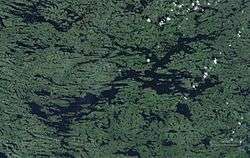 NASA image of Lacs des Loups Marins | |
 Lacs des Loups Marins Location in Quebec | |
| Location | Nunavik, Nord-du-Québec, Quebec |
| Coordinates | 56°31′36″N 73°32′43″W / 56.52667°N 73.54528°WCoordinates: 56°31′36″N 73°32′43″W / 56.52667°N 73.54528°W |
| Primary outflows | Nastapoka River |
| Basin countries | Canada |
| Max. length | 84 km (52 mi) |
| Max. width | 12 km (7.5 mi) |
| Surface area | 576 km2 (222 sq mi) |
| Surface elevation | 262 m (860 ft) |
| Frozen | November to June |
| References | [1][2][3][4] |
Lacs des Loups Marins is a lake in the north of the province of Quebec in Canada. It is located about 150 km east of Hudson Bay and about 20 km northeast of Lac à l'Eau Claire.
The name comes from its population of harbor seals (fr: loups marins or phoques). They belong to Phoca vitulina mellonae, the only seal subtype that lives year-round in fresh water.[5]
History
The lake was known as Lower Seal Lake then Seal Lake until 1967 when it was named Lacs des Loups Marins. It was named after the seals that live on the shores and in the lake. The Cree called the lake Musiwaw Achikunipi (lake of seals in the tundra).[6]
See also
- Nastapoka River, a watercourse
- List of lakes of Quebec
References
- ↑ "World Lake Database (Des Loups Marin)". Retrieved 2015-02-21.
- ↑ "Natural Resources Canada-Canadian Geographical Names (Lacs des Loups Marins)". Retrieved 2015-03-30.
- ↑ "Atlas of Canada Toporama". Retrieved 2015-03-30.
- ↑ Atlas of Canada. "Rivers in Canada". Archived from the original on 10 April 2007. Retrieved 2015-03-17.
- ↑ "Fisheries and Oceans Canada (Canadian Science Advisory Secretariat Quebec Region Science Advisory Report 2008/062)" (PDF). Retrieved 2015-04-05.
- ↑ "Commission de toponymie du Québec - Banque des noms de lieux - Toponyme: "Lacs Des-Loups-Marins"". Retrieved 2015-04-05.
External links
| Provinces |
|
|---|---|
| Territories | |
| |
This article is issued from
Wikipedia.
The text is licensed under Creative Commons - Attribution - Sharealike.
Additional terms may apply for the media files.