La Vespière
| La Vespière | |
|---|---|
 | |
 La Vespière Location within Normandy region  La Vespière | |
| Coordinates: 49°01′10″N 0°24′47″E / 49.0194°N 0.4131°ECoordinates: 49°01′10″N 0°24′47″E / 49.0194°N 0.4131°E | |
| Country | France |
| Region | Normandy |
| Department | Calvados |
| Arrondissement | Lisieux |
| Canton | Livarot |
| Intercommunality | Pays de l'Orbiquet |
| Government | |
| • Mayor (2008–2014) | Serge Saint |
| Area1 | 8.65 km2 (3.34 sq mi) |
| Population (2009)2 | 957 |
| • Density | 110/km2 (290/sq mi) |
| Demonym(s) | Vesperois |
| Time zone | UTC+1 (CET) |
| • Summer (DST) | UTC+2 (CEST) |
| INSEE/Postal code | 14740 /14290 |
| Elevation |
118–190 m (387–623 ft) (avg. 135 m or 443 ft) |
|
1 French Land Register data, which excludes lakes, ponds, glaciers > 1 km2 (0.386 sq mi or 247 acres) and river estuaries. 2 Population without double counting: residents of multiple communes (e.g., students and military personnel) only counted once. | |
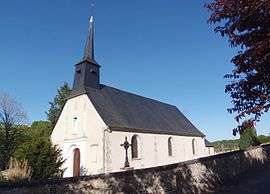
La Vespière is a former commune in the Calvados department in the Normandy region in northwestern France. On 1 January 2016, it was merged into the new commune of La Vespière-Friardel.[1]
Population
| Historical population | ||
|---|---|---|
| Year | Pop. | ±% |
| 1962 | 386 | — |
| 1968 | 402 | +4.1% |
| 1975 | 415 | +3.2% |
| 1982 | 731 | +76.1% |
| 1990 | 883 | +20.8% |
| 1999 | 972 | +10.1% |
| 2009 | 957 | −1.5% |
See also
References
- ↑ Arrêté préfectoral 22 December 2015 (in French)
| Wikimedia Commons has media related to La Vespière. |
This article is issued from
Wikipedia.
The text is licensed under Creative Commons - Attribution - Sharealike.
Additional terms may apply for the media files.