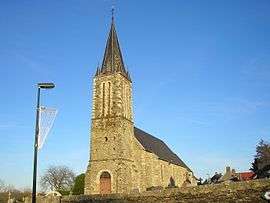
La Vacquerie
| La Vacquerie | |
|---|---|
 | |
 La Vacquerie Location within Normandy region  La Vacquerie | |
| Coordinates: 49°05′35″N 0°51′25″W / 49.0931°N 0.8569°WCoordinates: 49°05′35″N 0°51′25″W / 49.0931°N 0.8569°W | |
| Country | France |
| Region | Normandy |
| Department | Calvados |
| Arrondissement | Bayeux |
| Canton | Aunay-sur-Odon |
| Area1 | 10.18 km2 (3.93 sq mi) |
| Population (2009)2 | 286 |
| • Density | 28/km2 (73/sq mi) |
| Time zone | UTC+1 (CET) |
| • Summer (DST) | UTC+2 (CEST) |
| INSEE/Postal code | 14722 /14240 |
| Elevation |
80–200 m (260–660 ft) (avg. 122 m or 400 ft) |
|
1 French Land Register data, which excludes lakes, ponds, glaciers > 1 km2 (0.386 sq mi or 247 acres) and river estuaries. 2 Population without double counting: residents of multiple communes (e.g., students and military personnel) only counted once. | |
La Vacquerie is a former commune in the Calvados department in the Normandy region in northwestern France. On 1 January 2017, it was merged into the new commune Caumont-sur-Aure.[1]
Population
| Historical population | ||
|---|---|---|
| Year | Pop. | ±% |
| 1962 | 349 | — |
| 1968 | 324 | −7.2% |
| 1975 | 275 | −15.1% |
| 1982 | 265 | −3.6% |
| 1990 | 300 | +13.2% |
| 1999 | 298 | −0.7% |
| 2009 | 286 | −4.0% |
See also
References
- ↑ Arrêté préfectoral 8 September 2016 (in French)
| Wikimedia Commons has media related to La Vacquerie. |
This article is issued from
Wikipedia.
The text is licensed under Creative Commons - Attribution - Sharealike.
Additional terms may apply for the media files.