La Poma Department
| La Poma | |
|---|---|
| Department | |
.png) | |
| Coordinates: 24°43′8″S 66°12′0″W / 24.71889°S 66.20000°WCoordinates: 24°43′8″S 66°12′0″W / 24.71889°S 66.20000°W | |
| Country |
|
| Province |
|
| Capital | La Poma |
| Area[1] | |
| • Total | 4,447 km2 (1,717 sq mi) |
| Population (2001)[2] | |
| • Total | 1,735 |
| • Density | 0.39/km2 (1.0/sq mi) |
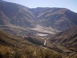
The Cuesta del Obispo, near La Poma, in Los Cardones National Park

View of Cobres
La Poma is a department located in Salta Province, Argentina. It is the least populated department of the province and its capital is the town of La Poma.
Geography
Overview
The department is located in the north-western area of the province, near the Andes, and includes the Puna de Atacama. It consists of 2 areas united by a territorial strip passing through the settlement of Muñano: in north the area of Cobres and in south the one of La Poma. It borders with Jujuy Province and the departments of Los Andes, Cachi and Rosario de Lerma.
Places
Towns and municipalities:
Other localities and places:
- Cerro Negro
- El Rodeo
- El Saladillo
- El Trigal
- El Volcán
- Muñano
- Potrerillos
- Tipán
See also
References
External links
![]()
- (in Spanish) La Poma Department on Salta Province website
| ||
This article is issued from
Wikipedia.
The text is licensed under Creative Commons - Attribution - Sharealike.
Additional terms may apply for the media files.