La Chaze-de-Peyre
| La Chaze-de-Peyre | |
|---|---|
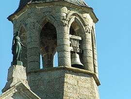 The bell tower of the church, in La Chaze-de-Peyre | |
 La Chaze-de-Peyre Location within Occitanie region  La Chaze-de-Peyre | |
| Coordinates: 44°42′13″N 3°15′14″E / 44.7036°N 3.2539°ECoordinates: 44°42′13″N 3°15′14″E / 44.7036°N 3.2539°E | |
| Country | France |
| Region | Occitanie |
| Department | Lozère |
| Arrondissement | Mende |
| Canton | Aumont-Aubrac |
| Area1 | 19.33 km2 (7.46 sq mi) |
| Population (1999)2 | 206 |
| • Density | 11/km2 (28/sq mi) |
| Time zone | UTC+1 (CET) |
| • Summer (DST) | UTC+2 (CEST) |
| INSEE/Postal code | 48047 /48130 |
| Elevation |
1,010–1,217 m (3,314–3,993 ft) (avg. 1,050 m or 3,440 ft) |
|
1 French Land Register data, which excludes lakes, ponds, glaciers > 1 km2 (0.386 sq mi or 247 acres) and river estuaries. 2 Population without double counting: residents of multiple communes (e.g., students and military personnel) only counted once. | |
La Chaze-de-Peyre is a former commune in the Lozère department in southern France. On 1 January 2017, it was merged into the new commune Peyre-en-Aubrac.[1]
See also
References
- ↑ Arrêté préfectoral 15 September 2016 (in French)
| Wikimedia Commons has media related to La Chaze-de-Peyre. |
This article is issued from
Wikipedia.
The text is licensed under Creative Commons - Attribution - Sharealike.
Additional terms may apply for the media files.