Längfluh
| Längfluh | |
|---|---|
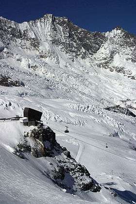 Cable car station surrounded by the Fee Glacier | |
| Highest point | |
| Elevation | 2,869 m (9,413 ft) [1] |
| Coordinates | 46°5′4.3″N 7°53′44.4″E / 46.084528°N 7.895667°ECoordinates: 46°5′4.3″N 7°53′44.4″E / 46.084528°N 7.895667°E |
| Geography | |
 Längfluh Location in Switzerland | |
| Location | Valais, Switzerland |
| Parent range | Pennine Alps |
The Längfluh (also spelled Längflue) is a rocky outcrop of the Pennine Alps, dividing the Fee Glacier above Saas Fee in the canton of Valais.
The Längfluh is accessible by cable car and is part of a ski area.
References
External links
- Längfluh saas-fee.ch
This article is issued from
Wikipedia.
The text is licensed under Creative Commons - Attribution - Sharealike.
Additional terms may apply for the media files.