Kyūshū Chūō Sanchi Quasi-National Park
| Kyūshū Chūō Sanchi Quasi-National Park | |
|---|---|
| 九州中央山地国定公園 | |
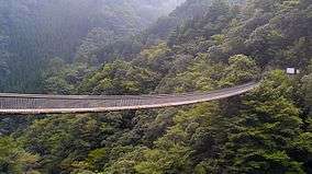 Umenokidokoro | |
 Map of Japan | |
| Location | Kumamoto/Miyazaki Prefecture, Japan |
| Coordinates | 32°25′59″N 130°58′08″E / 32.433°N 130.969°ECoordinates: 32°25′59″N 130°58′08″E / 32.433°N 130.969°E[1] |
| Area | 271 km2 (105 sq mi) |
| Established | May 15, 1982 |
Kyūshū Chūō Sanchi Quasi-National Park (九州中央山地国定公園 Kyūshū Chūō Sanchi Kokutei Kōen) is a Quasi-National Park in Kumamoto Prefecture and Miyazaki Prefecture, Japan.[2][3] It was founded on 15 May 1982 and has an area of 271 km2 (105 sq mi).[4] The park includes Aya Biosphere Reserve in its territory.[5]
See also
| Wikimedia Commons has media related to Kyūshū Chūō Sanchi Quasi-National Park. |
References
- ↑ "Kyushu - Chuo - Sanchi Quasi National Park". protectedplanet.net.
- ↑ "九州中央山地国定公園". Ministry of the Environment. Retrieved 10 May 2011.
- ↑ "壱岐対馬/九州中央山地/日豊海岸/祖母傾". National Parks Association of Japan. Archived from the original on 23 March 2012. Retrieved 10 May 2011.
- ↑ "List of National Parks". Ministry of the Environment. Retrieved 10 May 2011.
- ↑ "UNESCO - MAB Biosphere Reserves Directory". 5 June 2016. Archived from the original on 5 June 2016.
This article is issued from
Wikipedia.
The text is licensed under Creative Commons - Attribution - Sharealike.
Additional terms may apply for the media files.