Kwantung Leased Territory
| Kwantung Leased Territory 關東州 | |||||||||||||
|---|---|---|---|---|---|---|---|---|---|---|---|---|---|
|
1895 1905–1945 | |||||||||||||
 Coat of arms
| |||||||||||||
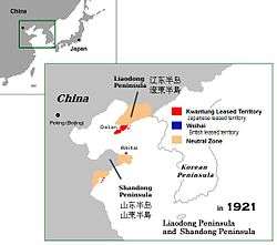 Kwantung Leased Territory in 1921. Area of influence and neutral zone. | |||||||||||||
| Status | Annexed dependency of the Empire of Japan | ||||||||||||
| Capital | Dairen | ||||||||||||
| Common languages |
| ||||||||||||
| Government | Constitutional monarchy | ||||||||||||
| Emperor of Japan | |||||||||||||
• 1895 1905–1912 | Emperor Meiji | ||||||||||||
• 1912–1926 | Emperor Taishō | ||||||||||||
• 1926–1945 | Emperor Showa | ||||||||||||
| Historical era | Empire of Japan | ||||||||||||
| April 17 1895 | |||||||||||||
| August 14 1945 | |||||||||||||
| Currency | Japanese yen | ||||||||||||
| |||||||||||||
| Today part of |
| ||||||||||||
.svg.png)
| Kwantung Leased Territory | |||||||||
| Chinese name | |||||||||
|---|---|---|---|---|---|---|---|---|---|
| Traditional Chinese | 關東州 | ||||||||
| Simplified Chinese | 关东州 | ||||||||
| |||||||||
| Japanese name | |||||||||
| Kanji | 関東州 | ||||||||
| Kana | かんとうしゅう | ||||||||
| |||||||||
The Kwantung Leased Territory was a Russian-leased territory (1898–1905), then a Japanese-leased territory (1905–1945) in the southern part of the Liaodong Peninsula (Japanese: 遼東半島) in the Republic of China that existed from 1898 to 1945. It was one of the territorial concessions that the Chinese government under the Qing Dynasty was compelled to award to foreign countries during the second half of the 19th century. The territory included the militarily and economically significant ports of Lüshunkou (Port Arthur, Port-Artur in Russian, or Ryojun in Japanese) and Dalian (Dalniy, Dal'nii in Russian, or Dairen in Japanese).
Etymology
The name Kwantung, or Guāndōng (關東) in pinyin, means "east of Shanhai Pass", a reference to part of Qinhuangdao in today's Hebei province, at the eastern end of the Great Wall of China. The name originally referred to all of Manchuria but later came to be used more narrowly for the area of the leased territory. In Japanese it is pronounced Kantō and it is often referred to as Kantō-shū to avoid confusion with the Kantō region surrounding the capital Tokyo.
History
In Qing dynasty China, the Liaodong Peninsula was administratively part of Liaoning Province. In 1882, the Beiyang Fleet established a naval base and coaling station at Lüshunkou near the southern end of the peninsula.
The Empire of Japan occupied the region during the First Sino-Japanese War (1894–1895), and under the terms of the Treaty of Shimonoseki signed by Japan and China ending the war in April 1895, Japan gained full sovereignty of the area. However, within weeks, Germany, France and Russia pressured Japan to cede the territory back to China, in what was called the Triple Intervention.[1]
In December 1897, Russian naval vessels entered Lüshunkou harbor, which they began to use as a forward base of operations for patrols off of northern China, Korea and in the Sea of Japan. The Russian Empire renamed the harbor Port Arthur. In March 1898 Russia formally leased the region for 25 years from China. The leased area extended to the northern shore of Yadang Bay on the western side of the peninsula; on the eastern side it reached Pikou; Yevgeni Ivanovich Alekseyev, chief of Russian Pacific Fleet, became the head of this territory. The peninsula north of the lease was made a neutral territory in which China agreed not to offer concessions to other countries. In 1899, Russia founded the town of Dalniy (meaning "distant" or "remote"), just north of the naval base at Port Arthur. This would later become the city of Dalian (Dairen).
In 1898 Russia began building a railroad north from Port Arthur to link Dalniy with the Chinese Eastern Railway at Harbin; this spur line was the South Manchurian Railway.
Under the Portsmouth Treaty (1905) resulting from the Russo-Japanese War, Japan replaced Russia as leaseholder. Port Arthur was renamed Ryojun, and Dalniy was renamed Dairen. Japan also obtained extraterritorial rights in the region north of the territory adjacent to the 885 kilometres (550 mi) South Manchurian Railway in 1905 (i.e. the South Manchurian Railway Zone), which was extended north of Mukden to Changchun. These rights, along with the railway and several spur lines were passed to the corporation known as the South Manchurian Railway Company.[2]
Japan established the Kwantung Governor-general (関東都督府 Kantō Totokufu) to administer the new territory, and based the Kwantung Garrison to defend it and the railway. The Kwantung Garrison later became the Kwantung Army, which played an instrumental role in the founding of Manchukuo. In negotiations with the Republic of China under the Twenty-One Demands, the terms of the lease of the Kwantung Leased Territory were extended to 99 years, or until 1997 (as the British did in Hong Kong's New Territories).
After the foundation of Japanese-controlled Manchukuo in 1932, Japan regarded the sovereignty of the leased territory as transferred from China to Manchukuo. A new lease agreement was contracted between Japan and the government of Manchukuo, and Japan transferred the South Manchurian Railway Zone to Manchukuo. However, Japan retained the Kwantung Leased Territory as a territory apart from the nominally-independent Manchukuo until its surrender at the end of World War II in 1945.
After World War II, the Soviet Union occupied the territory and the Soviet Navy made use of the Ryojun Naval Base. The Soviet Union turned it over to the People's Republic of China in 1955.
Administration
In a reorganization of 1919, the Kwantung Garrison was renamed the Kwantung Army and separated from the civilian administration of the territory, which was designated the Kwantung Bureau (関東庁 Kantō-cho). The Kantō-cho initially directly reported to the office of the Prime Minister of Japan; later it was subordinated to the Ministry of Colonial Affairs. Internally, the Kwantung Leased Area was divided into two districts, with two cities and nine towns. The city assemblies were in part elected, and in part appointed by the governor.[3]
Economy
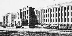
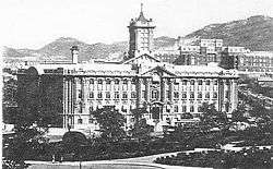
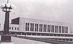
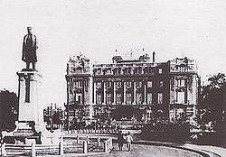
Massive capital investment was concentrated in Dairen (now the capital of the territory), wherein Japanese firms developed a significant industrial infrastructure, as well as creating a first class port out of the mediocre natural harbor. The facilities of the port at Dairen and its free trade port status made it the principal trade gateway to northeast China. The South Manchurian Railway Company was headquartered in Dairen, and some of the profits from its operation were channelled into transforming Dairen into a showcase city of modern city planning and modern architecture, with hospitals, universities and a large industrial zone.[4]
Demographics
In the Japanese national census of 1935, the population of the Kwantung Leased Territory was 1,034,074, of whom 168,185 were Japanese nationals. The numbers excluded military personnel. The area of the territory was 3,500 square kilometres (1,350 sq mi).
Governors-General
| # | Name | From | To |
|---|---|---|---|
| 1 | General Baron Yoshimasa Ōshima (大島義昌) | 10 October 1905 | 26 April 1912 |
| 2 | Lieutenant General Yasumasa Fukushima (福島安正) | 26 April 1912 | 15 September 1914 |
| 3 | Lieutenant General Akira Nakamura (中村覚) | 15 September 1914 | 31 July 1917 |
| 4 | Lieutenant General Yujiro Nakamura (中村雄次郎) | 31 July 1917 | 12 April 1919 |
| 5 | Gonsuke Hayashi (林権助) | 12 April 1919 | 24 May 1920 |
| 6 | Isaburo Yamagata (山県伊三郎) | 24 May 1920 | 8 September 1922 |
| 7 | Ijuin Hikokichi (伊集院彦吉) | 8 September 1922 | 19 September 1923 |
| 8 | Hideo Kodama (児玉秀雄) | 26 September 1923 | 17 December 1927 |
| 9 | Kenjiro Kinoshita (木下謙次郎) | 17 December 1927 | 17 August 1929 |
| 10 | Masahiro Ota (太田政弘) | 17 August 1929 | 16 January 1931 |
| 11 | Seiji Tsukamoto (塚本清治) | 16 January 1931 | 11 January 1932 |
| 12 | Mannosuke Yamaoka (山岡万之助) | 11 January 1932 | 8 August 1932 |
| 13 | General Nobuyoshi Mutō (武藤信義) | 8 August 1932 | 28 July 1933 |
| 14 | General Takashi Hishikari (菱刈隆) | 28 July 1933 | 10 December 1934 |
| 15 | General Jirō Minami (南次郎) | 10 December 1934 | 6 March 1936 |
| 16 | General Kenkichi Ueda (植田謙吉) | 6 March 1936 | 7 September 1939 |
| 17 | General Yoshijirō Umezu (梅津美治郎) | 7 September 1939 | 18 July 1944 |
| 18 | General Otozō Yamada (山田乙三) | 18 July 1944 | 28 August 1945 |
See also
References
- Coox, Alvin (1990). Nomonhan: Japan Against Russia, 1939. Stanford University Press. ISBN 0-8047-1835-0.
- Hsu, Immanuel C.Y. (1999). The Rise of Modern China. Oxford University Press. ISBN 0-19-512504-5.
- Low, Morris (2005). Building a Modern Japan: Science, Technology, and Medicine in the Meiji Era and Beyond. Palgrave Macmillan. ISBN 1-4039-6832-2.
- Quigley, Harold S (2007) [1932]. Japanese Government and Politics. Thomson Press. ISBN 1-4067-2260-X.
- Young, Louise (1999). Japan's Total Empire: Manchuria and the Culture of Wartime Imperialism. University of California Press. ISBN 0-520-21934-1.
Notes
External links
| Wikimedia Commons has media related to Kwantung Leased Territory. |