Kvaløya, Finnmark
| Native name: Fálá | |
|---|---|
 Kvaløya Location of the island  Kvaløya Kvaløya (Norway) | |
| Geography | |
| Location | Finnmark, Norway |
| Coordinates | 70°36′N 23°51′E / 70.600°N 23.850°ECoordinates: 70°36′N 23°51′E / 70.600°N 23.850°E |
| Area | 336 km2 (130 sq mi) |
| Highest elevation | 629 m (2,064 ft) |
| Highest point | Svartfjellet |
| Administration | |
|
Norway | |
| County | Finnmark |
| Municipality | Kvalsund Municipality |
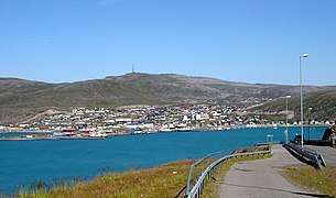
Kvaløya (Northern Sami: Fálá) is a large island in Finnmark county, Norway. The 336-square-kilometre (130 sq mi) island is divided between Hammerfest Municipality and Kvalsund Municipality. The town of Hammerfest is located in the western shore of the island. Other villages on the island include Forsøl, Rypefjord, and Stallogargo.
The island is connected to the mainland via Norwegian National Road 94 which crosses the Kvalsund Bridge in the southern part of the island. Most of the settlements on the island are on the western shore along the highway 94. There is a ferry connection between Kvaløya and the island of Seiland to the southwest. The highest point on the mountainous island is the 629-metre (2,064 ft) tall mountain Svartfjellet.[1]
See also
References
- ↑ Store norske leksikon. "Kvaløya i Finnmark" (in Norwegian). Retrieved 2013-01-24.