Kurand, California
Coordinates: 39°31′47″N 122°17′23″W / 39.52972°N 122.28972°W
| Kurand | |
|---|---|
| Former settlement | |
 Kurand Location in California | |
| Coordinates: 39°31′47″N 122°17′23″W / 39.52972°N 122.28972°W | |
| Country | United States |
| State | California |
| County | Glenn County |
| Elevation[1] | 194 ft (59 m) |
Kurand is a former settlement in Glenn County, California.[1] It was located on the Southern Pacific Railroad 9.5 miles (15 km) east-southeast of Fruto,[2] at an elevation of 194 feet (59 m).[1] It still appeared on maps as of 1944.[1]
References
Municipalities and communities of Glenn County, California, United States | ||
|---|---|---|
| Cities | 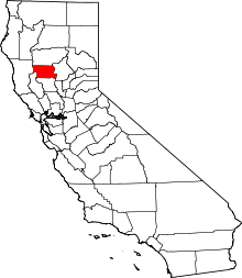 | |
| CDPs | ||
| Unincorporated communities | ||
| Indian reservations | ||
| Ghost towns | ||
This article is issued from
Wikipedia.
The text is licensed under Creative Commons - Attribution - Sharealike.
Additional terms may apply for the media files.