Kukava
| Kukava | |
|---|---|
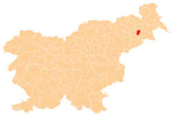
 Kukava Location in Slovenia | |
| Coordinates: 46°28′0.31″N 15°57′49.69″E / 46.4667528°N 15.9638028°ECoordinates: 46°28′0.31″N 15°57′49.69″E / 46.4667528°N 15.9638028°E | |
| Country |
|
| Traditional region | Styria |
| Statistical region | Drava |
| Municipality | Juršinci |
| Area | |
| • Total | 2 km2 (0.8 sq mi) |
| Elevation | 300.7 m (986.5 ft) |
| Population (2002) | |
| • Total | 208 |
| [1] | |
Kukava (pronounced [ˈkuːkaʋa]) is a settlement on the western edge of the Slovene Hills (Slovene: Slovenske gorice) in the Municipality of Juršinci in northeastern Slovenia. Traditionally the area was part Styria and is now included with the rest of the municipality in the Drava Statistical Region.[2]
A small chapel-shrine with a belfry in the settlement was built in 1931 on the site of an older church demolished in the late 18th century.[3]
References
External links
| Settlements | Administrative centre: Juršinci
|  | ||||
|---|---|---|---|---|---|---|
| Notable people |
| |||||
This article is issued from
Wikipedia.
The text is licensed under Creative Commons - Attribution - Sharealike.
Additional terms may apply for the media files.