Errachidia
| Errashidia Imetɣaren قصر السوق Ksar es-Souk ⵉⵖⵔⴻⵎ ⴻⵏ ⵡⴻⵍⵣⵓⵣ Iɣrem en Welzuz | ||
|---|---|---|
| City | ||
| Eṛṛacidiya / الرشيدية | ||
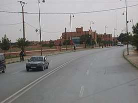    Main road in Er Rashidia | ||
| ||
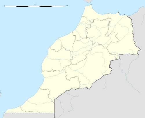 Errashidia location of Errachidia in Morocco | ||
| Coordinates: 31°55′55″N 4°25′28″W / 31.93194°N 4.42444°WCoordinates: 31°55′55″N 4°25′28″W / 31.93194°N 4.42444°W | ||
| Country |
| |
| Region | Drâa-Tafilalet | |
| Province | Errachidia | |
| Elevation | 1,009 m (3,310 ft) | |
| Population (2014)[1] | ||
| • Total | 92,374 | |
Errachidia (Arabic: الرشيدية, ar-Rachīdīya, Berber languages: ⵉⵎⵜⵖⴻⵔⵏ Imtgheren) is a city in Morocco, located in the Errachidia Province, in the region of Drâa-Tafilalet. Both languages Berber and Arabic spoken largely in this city.
Toponymy
Formerly known as "Ksar Es Souk" (Berber languages: ⵉⵖⵔⴻⵎ ⵏ ⵓⵍⵣⵓⵣ, Ighrem n Ulzuz), the city was renamed Errachidia around 1975 in honor of the second son of Hassan II, Moulay Rachid.
Culture
The city was part of the route of the 2006 and 2007 Dakar Rally.
Climate
| Climate data for Er Rachidia | |||||||||||||
|---|---|---|---|---|---|---|---|---|---|---|---|---|---|
| Month | Jan | Feb | Mar | Apr | May | Jun | Jul | Aug | Sep | Oct | Nov | Dec | Year |
| Average high °C (°F) | 15.7 (60.3) |
18 (64) |
21.6 (70.9) |
26.1 (79) |
30.2 (86.4) |
35.5 (95.9) |
40.6 (105.1) |
39.4 (102.9) |
29.5 (85.1) |
26.3 (79.3) |
20.3 (68.5) |
16.7 (62.1) |
26.7 (80) |
| Daily mean °C (°F) | 9.1 (48.4) |
11.2 (52.2) |
14.4 (57.9) |
18.5 (65.3) |
22.1 (71.8) |
27.2 (81) |
31.6 (88.9) |
30.7 (87.3) |
21.8 (71.2) |
19.3 (66.7) |
13.8 (56.8) |
10.3 (50.5) |
19.2 (66.5) |
| Average low °C (°F) | 2.5 (36.5) |
4.4 (39.9) |
7.3 (45.1) |
10.9 (51.6) |
14.1 (57.4) |
19 (66) |
22.6 (72.7) |
22.1 (71.8) |
14.1 (57.4) |
12.4 (54.3) |
7.4 (45.3) |
3.9 (39) |
11.7 (53.1) |
| Average precipitation mm (inches) | 8 (0.31) |
6 (0.24) |
8 (0.31) |
10 (0.39) |
8 (0.31) |
4 (0.16) |
3 (0.12) |
6 (0.24) |
17 (0.67) |
20 (0.79) |
18 (0.71) |
19 (0.75) |
127 (5) |
| Source: Climate-data.org | |||||||||||||
References
- ↑ "POPULATION LÉGALE DES RÉGIONS, PROVINCES, PRÉFECTURES, MUNICIPALITÉS, ARRONDISSEMENTS ET COMMUNES DU ROYAUME D'APRÈS LES RÉSULTATS DU RGPH 2014" (in Arabic and French). High Commission for Planning, Morocco. 8 April 2015. Retrieved 29 September 2017.
Capital: Errachidia | ||
| Provinces | 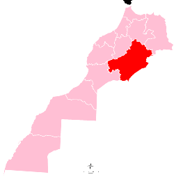 | |
| Cities | ||
This article is issued from
Wikipedia.
The text is licensed under Creative Commons - Attribution - Sharealike.
Additional terms may apply for the media files.