Krenkel Bay
| Krenkel Bay Бухта Кренкеля | |
|---|---|
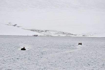
 View of the shore of Krenkel Bay | |
 Landsat image of Komsomolets island | |
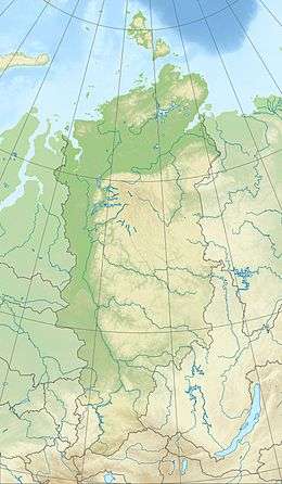 Krenkel Bay Location in Krasnoyarsk Krai | |
| Location | Komsomolets Island, Severnaya Zemlya, Krasnoyarsk Krai |
| Coordinates | 80°30′N 97°50′E / 80.500°N 97.833°ECoordinates: 80°30′N 97°50′E / 80.500°N 97.833°E |
| Ocean/sea sources | Laptev Sea |
| Basin countries | Russia |
| Max. length | 11 km (6.8 mi)[1] |
| Max. width | 25 km (16 mi) |
| Islands | Ozerny Island |
Krenkel Bay (Russian: Бухта Кренкеля, Bukhta Krenkelya),[2] is a bay in Severnaya Zemlya, Krasnoyarsk Krai, Russia.[1]
History
This bay was named by the 1930–1932 expedition to the archipelago led by Georgy Ushakov and Nikolay Urvantsev after Soviet Arctic explorer and radio operator Ernst Krenkel (1895–1978).[3]
Geography
Krenkel Bay is a body of water in the northeastern area of Komsomolets Island, the northernmost island of Severnaya Zemlya.[4]
The bay is open to the southeast. It is regular in shape and has a width of about 25 km (16 mi). The edge of the massive Academy of Sciences Glacier runs all along the western shore, while the northern shoreline is bound by a stretch of unglaciated area.[1] Ozerny Island lies close to the northeastern headland of the bay.[5]
See also
References
- 1 2 3 GoogleEarth
- ↑ "Bukhta Krenkelya". Mapcarta. Retrieved 24 December 2016.
- ↑ Архипелаг Северная Земля — один из наиболее крупных районов оледенения на территории России
- ↑ Map U-47-XXXI,XXXII,XXXIII бух. Кренкеля. Scale: 1 : 200 000. Состояние местности на 1988 год. Издание 1992 г.
- ↑ Russian map T-48-VII,VIII,IX - Т-47,48
External links

- Eurasian Arctic Tectonics - DiVA