Koyuk, Alaska
| Koyuk Quyuk | |
|---|---|
| City | |
 Koyuk Location in Alaska | |
| Coordinates: 64°55′52″N 161°9′31″W / 64.93111°N 161.15861°WCoordinates: 64°55′52″N 161°9′31″W / 64.93111°N 161.15861°W | |
| Country | United States |
| State | Alaska |
| Census Area | Nome |
| Incorporated | October 19, 1970[1] |
| Government | |
| • Mayor | Darin Douglas, Sr.[2] |
| • State senator | Donald Olson (D) |
| • State rep. | Neal Foster (D) |
| Area[3] | |
| • Total | 4.77 sq mi (12.35 km2) |
| • Land | 4.77 sq mi (12.35 km2) |
| • Water | 0.00 sq mi (0.00 km2) |
| Elevation | 33 ft (10 m) |
| Population (2010) | |
| • Total | 332 |
| • Estimate (2016)[4] | 369 |
| • Density | 77.39/sq mi (29.88/km2) |
| Time zone | UTC-9 (Alaska (AKST)) |
| • Summer (DST) | UTC-8 (AKDT) |
| ZIP code | 99753 |
| Area code | 907 |
| FIPS code | 02-41940 |
Koyuk (Quyuk in Iñupiaq) is a city in the Nome Census Area, Alaska, United States. The population was 332 at the 2010 census, up from 297 in 2000.
Geography
Koyuk is located at 64°55′52″N 161°9′31″W / 64.93111°N 161.15861°W (64.931099, -161.158480).[5] The village is located on the northern bank of the Koyuk River where it drains into Norton Bay.
According to the United States Census Bureau, the city has a total area of 4.7 square miles (12 km2), all of it land.
Demographics
| Historical population | |||
|---|---|---|---|
| Census | Pop. | %± | |
| 1930 | 110 | — | |
| 1940 | 100 | −9.1% | |
| 1950 | 134 | 34.0% | |
| 1960 | 129 | −3.7% | |
| 1970 | 122 | −5.4% | |
| 1980 | 188 | 54.1% | |
| 1990 | 231 | 22.9% | |
| 2000 | 297 | 28.6% | |
| 2010 | 332 | 11.8% | |
| Est. 2016 | 369 | [4] | 11.1% |
| U.S. Decennial Census[6] | |||
Koyuk first appeared on the 1930 U.S. Census as an unincorporated village. It formally incorporated in 1970.
As of the census[7] of 2000, there were 297 people, 80 households, and 59 families residing in the city. The population density was 62.7 people per square mile (24.2/km²). There were 95 housing units at an average density of 20.1 per square mile (7.7/km²). The racial makeup of the city was 4.71% White, 91.92% Native American, 0.67% Asian, and 2.69% from two or more races.
There were 80 households out of which 53.8% had children under the age of 18 living with them, 35.0% were married couples living together, 18.8% had a female householder with no husband present, and 26.3% were non-families. 21.3% of all households were made up of individuals and 2.5% had someone living alone who was 65 years of age or older. The average household size was 3.71 and the average family size was 4.31.
In the city, the age distribution of the population shows 41.8% under the age of 18, 8.8% from 18 to 24, 30.0% from 25 to 44, 16.5% from 45 to 64, and 3.0% who were 65 years of age or older. The median age was 25 years. For every 100 females, there were 121.6 males. For every 100 females age 18 and over, there were 127.6 males.
The median income for a household in the city was $30,417, and the median income for a family was $20,625. Males had a median income of $25,625 versus $11,563 for females. The per capita income for the city was $8,736. About 29.3% of families and 28.0% of the population were below the poverty line, including 39.7% of those under the age of eighteen and 25.0% of those sixty five or over.
Education
Koyuk is served by the Bering Strait School District. Koyuk-Malemute School serves grades Pre-K through 12.
References
- ↑ 1996 Alaska Municipal Officials Directory. Juneau: Alaska Municipal League/Alaska Department of Community and Regional Affairs. January 1996. p. 87.
- ↑ 2015 Alaska Municipal Officials Directory. Juneau: Alaska Municipal League. 2015. p. 93.
- ↑ "2016 U.S. Gazetteer Files". United States Census Bureau. Retrieved Jun 22, 2017.
- 1 2 "Population and Housing Unit Estimates". Retrieved June 9, 2017.
- ↑ "US Gazetteer files: 2010, 2000, and 1990". United States Census Bureau. 2011-02-12. Retrieved 2011-04-23.
- ↑ "Census of Population and Housing". Census.gov. Archived from the original on May 12, 2015. Retrieved June 4, 2015.
- ↑ "American FactFinder". United States Census Bureau. Retrieved 2008-01-31.
Municipalities and communities of Nome Census Area, Alaska, United States | ||
|---|---|---|
| Cities | 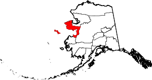 | |
| CDP | ||
| Unincorporated communities | ||
| Ghost towns | ||