Koumbia, Tuy, Burkina Faso
| Koumbia, Tuy | |
|---|---|
| Town | |
%2CBF_thu10aug2017-0948h.jpg) Municipal administration building (August 2017) | |
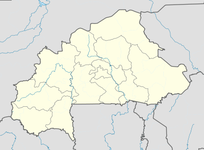 Koumbia, Tuy Location within Burkina Faso | |
| Coordinates: 11°13′37″N 3°42′48″W / 11.226898°N 3.713379°WCoordinates: 11°13′37″N 3°42′48″W / 11.226898°N 3.713379°W | |
| Country |
|
| Region | Hauts-Bassins |
| Province | Tuy |
| Department | Koumbia |
| Time zone | UTC+0 (GMT) |
%2CBF_thu10aug2017-0957h.jpg)
Street in Koumbia town with sign pointing to the municipal administration building (August 2017)
Koumbia is a town in southwestern Burkina Faso, capital of the rural municipality (commune rurale) and Department of Koumbia in Tuy Province (Hauts-Bassins Region). It is situated about 70 km east of Bobo-Dioulasso along the trunk road Route nationale N1 to Ouagadougou where the Route régionale R25 joins the N1.[1]
This town should not be confused with the much smaller village of Koumbia in Fara Department of Balé Province (Boucle du Mouhoun Region)[2]
References
This article is issued from
Wikipedia.
The text is licensed under Creative Commons - Attribution - Sharealike.
Additional terms may apply for the media files.