Kothakota
| Kothakota Municipality కొత్తకోట | |
|---|---|
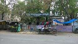 Panchayat Office(old police station), Kothakota | |
| Nickname(s): New York | |
 Kothakota Municipality Location in Telangana, India  Kothakota Municipality Kothakota Municipality (India) | |
| Coordinates: 16°22′00″N 77°58′00″E / 16.3667°N 77.9667°ECoordinates: 16°22′00″N 77°58′00″E / 16.3667°N 77.9667°E | |
| Country |
|
| State | Telangana |
| District | Wanaparthy |
| Elevation | 401 m (1,316 ft) |
| Telugu, urdu | |
| • Official | Telugu |
| Time zone | UTC+5:30 (IST) |
| PIN | 509381 |
| Vehicle registration | TS06 |
| Nearest city | Wanaparthy |
| Lok Sabha constituency | Mahabubnagar |
| Vidhan Sabha constituency | Devarakadra |
| Climate | hot (Köppen) |
| Website |
telangana |
Kothakota is a Municipality and mandal in Wanaparthy district, Telangana.[1]
Geography
Kothakota is located at 16°22′00″N 77°58′00″E / 16.3667°N 77.9667°E.[2] It has an average elevation of 401 metres (1318 ft).
References
- ↑ "District Administration – Formation/Reorganization of District, Revenue Divisions and Mandals in Wanaparthy District – Final Notification - Orders – Issued" (PDF). Wanaparthy District. Retrieved 21 July 2017.
- ↑ "Maps, Weather, and Airports for Kothakota, India". Fallingrain.com. Retrieved 2016-12-01.
This article is issued from
Wikipedia.
The text is licensed under Creative Commons - Attribution - Sharealike.
Additional terms may apply for the media files.