Kot Addu, Pakistan
| Kot Addu كوٹ ادُّو | |
|---|---|
| City | |
 Kot Addu Railway Station | |
 Kot Addu  Kot Addu | |
| Coordinates: 30°27′59″N 70°57′56″E / 30.46639°N 70.96556°ECoordinates: 30°27′59″N 70°57′56″E / 30.46639°N 70.96556°E | |
| Country | Pakistan |
| Province | Punjab |
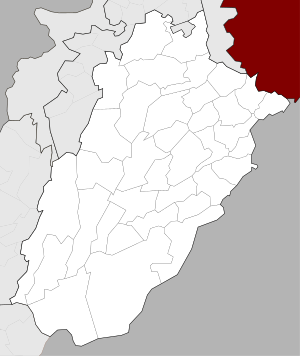
| District | Muzaffargarh District |
| Time zone | UTC+5 (PST) |
Kot Addu is a city and tehsil in the Muzaffargarh District of the southern part of the Punjab province of Pakistan. This city is subdivided into 30 Union Councils[1] and has a population of over 400,000,[2] making it the 150th largest city in Pakistan. It is located just east of the Indus River, about 866 km (538 mi) from Karachi, 600 km (370 mi) from Islamabad, 100 km from Multan, 80 km from D.G.Khan, 60 km (37 mi) from Muzaffargarh, 60 km from Layyah, and 16 km (9.9 mi) from Taunsa Barrage. Kot Addu City attracts a large number of tourists every year, due to the Indus river and public gardens among other things. The city is served by Kot Addu Junction railway station.The Zip code of Kot Addu is 34050.
Demography
- Total population
- 8,08,438 persons
- Location on Google Map
- N 30° 28' 34 E 70° 57' 52
- Total Area
- 877,989 acres (355,310 ha)
The city contains a total of 31 Union councils, which are listed below.
|
|
Location
The city of Kot Addu is located in the southern area of Punjab province, almost at the exact center of Pakistan. The area around the city is a flat plain and is ideal for agriculture. There are two main canals (Muzaffar, and T.P. link) and eight sub-canals that cross Kot Addu, providing water from the Indus River. The geographical coordinates of the city, according to Google Maps, are: N 30° 28' 34" E 70° 57' 52".
Geography and climate
Kot Addu is located almost exactly at the geographical center of Pakistan. The closest major city is Multan. The area around the city is a flat alluvial plain and is ideal for agriculture, with many citrus and mango farms. There are also canals that cut across the Muzaffargarh District, providing water to farms. During the monsoon season, the land close to the Taunsa Barrage is usually flooded.
Kot Addu has an arid climate with very hot summers and mild winters. The city has experienced some of the most extreme weather in Pakistan. The highest recorded temperature was approximately 51 °C (129 °F), and the lowest recorded temperature was approximately −1 °C (30 °F). The average rainfall is roughly 127 millimeters (5.0 inches). Dust storms are a common occurrence within the city.
Education
Like other major cities in Punjab, Kot Addu features a rich educational landscape. In the last few years, the city has observed a surge in the number of educational institutions. Colleges include private commerce and science colleges, schools, academies like Punjab Inter Science Academy, and a cadet college. Government degrees are provided for both men and women. Several colleges are affiliated with the Bahuddin Zakrya University, B.Z.U. Multan Pakistan, and Punjab University Lahore Pakistan. The names of some private institutions are, Kot Addu School of Economics and Management Sciences (Mr. Fiaz Hussain Malik, director), Punjab Higher Secondary School, Bismillah. Inter Science Academy, Punjab Group of Colleges, My School System, Dar-E-Arqam School, Oxford Grammar School, Professor Academy and etc. A Government Technical College is also under construction.
School and Colleges
- Government College of Commerce Kot Addu
- Government Post Graduate College Kot Addu
- Government College of Technology Lal Meer Kot ADDU
- Elimentary Teachers Training College Kot Addu
- Mairi Darsgah
- New Ibn-e-Sena School Kot Addu
- BrightWay School System
- My School System Kot Addu
- Moon of Heaven Commerce College (Regd) www.moonofheaven.com
- Moon of Heaven Academy www.moonofheaven.com
- Dar-e-Arqam School Kot Addu Campus.
- Allied School
- City School
- IIUI (School) Kot Adu campus
- Govt. P/s School Basti sirai
- Govt. High School #01
- C.C.U. The Creator children university
- Ahmad Schools (PTV) Limited
- New Punjab Higher Secondary School Kot Addu
- Learners House school (Kot Addu)
- City Public School Zia Colony, Kot Addu
- Vocational Training Institute Kot Addu.
- Mairi Darsgah Secondary School for Boys and Girls
- Govt. boys High School
- Maryam Public Secondary School
- Hira Girls Science Academy Kot Addu.
Taunsa Barrage
Taunsa Barrage is a barrage on the River Indus. It is situated 20 kilometres (12 mi) southeast of Taunsa Sharif and 16 kilometres (9.9 mi) from Kot Addu. This barrage controls water flow in the River Indus for irrigation and flood control purposes. This barrage serves 2.351 million acres (951,400 hectares) besides diverting flows from Indus River to the Chenab River through Taunsa Panjnad (TP) Link Canal. The barrage also serves as an arterial road bridge, a railway bridge, and crossing for gas and oil pipelines, telephone line and extra high voltage (EHV) transmission lines.[6] In 2011, the rehabilitation of the Taunsa Barrage was blamed for devastation of the Muzaffargarh district during the 2010 Pakistan floods.[7] Critics blamed the rehabilitation of the barrage, alleging that it failed to raise its height and strengthen protective embankments, used dysfunctional computer control system of the hoist gates and ignored hill-torrent management.[8]
Industry
Kot Adu is a prominent commercial and industrial city in the Punjab province. It is connected by road and rail with Lahore, Karachi, Multan, Rawalpindi, Islamabad, Quetta, and Faisalabad; and also by air from Multan Airport to all Pakistani airports.
Main Industries
- Pak Arab Oil Refinery (PARCO)[9]
Power Stations
Kot Adu Power Company
The Kot Addu Power Company Limited (KAPCO) [10] was incorporated in 1996, location in Kot Addu, District Muzaffargarh, Punjab, Pakistan. Kot Addu Power Plant was built by the Pakistan Water and Power Development Authority (WAPDA). In April 2000, the Company was incorporated as a public limited company. Kot Addu Power Plant produces 1,600 MW of electricity. On 18 April 2005 the Company was formally listed on all three Stock Exchanges of Pakistan.[21]
- Lal-Peer Thermal Power Station[11]
Sugar Mills
Besides these, cotton factories, foundries, cotton, woolen, and silk textile mills, flour, and oil mills are also located in this region. This area is famous for its handicrafts (Kundra work), and cottage industries.
Information technology industry
With the constantly changing environment in the world and as information technology has become increasingly important, Kot Addu has also adopted this change with a great positive response. The first professional information technology center was introduced in 2002, named I.TECH,[14] which then also opened a branch in Dubai in 2006, U.A.E. It is a prominent institution in that region which mainly focuses on web designing and development. There are many other institutions contributing towards education in Information Technology. It is clear from the interest of the people that this region needs some Great Government I.T. institution. In November 2009 the Government of Pakistan also opened a Great Technical College named LAL-MEER technical college in the Union of Kot Addu.[15]
Health centers
There is one government civil hospital and several private hospitals in the city, beside much small government and private hospitals in the union councils.
Agriculture
Kot Addu is an important agricultural area. The total area of Tehsil Kot Addu is 877,989 acres (355,310 ha), of which 4,24,521 acres are under cultivation. Main crops of the area include corn, cotton, rice, sugarcane, tobacco, wheat, and vegetables. Bajra, moong, mash, masoor, and oil seeds (such as mustard and sunflower seeds) are also grown in the district.
Mangoes, citrus, guavas, and pomegranates are Kot Addu's most important fruit crops. Minor fruit crops include dates, jaman, pears, falsa and bananas are also grown.
One other local fruit is called a bare (Berry) . It is one of the main fruits grown in this region. Due to flooding, the crops are now rare, especially cotton and wheat products affected by this flooding. So, now a majority of the agricultural lands are covered by sugarcane. People either sell this sugarcane to sugar mills or produce Jaggery from sugarcane.
Notable people
- Inayat Hussain Bhatti (Film Industry)
- Mushtaq Ahmed Gurmani (Ex-Governor West Pakistan)
- Pathanay Khan (Poet, Pride of Performance)
- Ghulam Mustafa Khar (Ex-Governer and Chief Minister Punjab) *Hina Rabbani Khar (Ex-Foreign Minister Pakistan)
- Sultan Mehmood(Ex-Minister)
- Mian Shabbir Ali Qureshi (Federal Minister)
See also
References
- 1 2 Tehsils & Unions in the District of Muzaffargarh - Government of Pakistan Archived 9 February 2012 at the Wayback Machine.
- ↑ "Where is Kot Addu, Pakistan?". WorldAtlas. Retrieved 2017-10-25.
- ↑ Muzaffar Garh Demographic
- ↑ Google Map
- ↑ District administration (Kot Adu)
- ↑ PLANNING AND DESIGN OF TAUNSA BARRAGE REHABILITATION PROJECT S.M.A. Zaidi, M. Akram Khan, Saif ur Rehman
- ↑ "Sindhu Bachao Tarla protest against WB". Pakistan Today. 2011-12-03.
- ↑ "Taunsa Barrage project: Affected people continue protest". The Express Tribune. 2011-12-03.
- ↑ PARCO
- ↑ KAPCO
- ↑ Pakistan Government Archived 26 May 2008 at the Wayback Machine.
- ↑ Pakistan Government
- ↑ Pakistan Government
- ↑ Kot Addu I.T. Institutions
- ↑ Government of Pakistan