Kostanjek
| Kostanjek | |
|---|---|
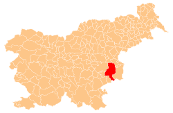
 Kostanjek Location in Slovenia | |
| Coordinates: 46°0′32.26″N 15°32′29.15″E / 46.0089611°N 15.5414306°ECoordinates: 46°0′32.26″N 15°32′29.15″E / 46.0089611°N 15.5414306°E | |
| Country |
|
| Traditional region | Styria |
| Statistical region | Lower Sava |
| Municipality | Krško |
| Area | |
| • Total | 2.97 km2 (1.15 sq mi) |
| Elevation | 337.7 m (1,107.9 ft) |
| Population (2002) | |
| • Total | 135 |
| [1] | |
Kostanjek (pronounced [kɔˈstaːnjək], German: Kosteinek[2]) is a settlement north of Zdole in the Municipality of Krško in eastern Slovenia. The area was traditionally part of Styria. It is now included with the rest of the municipality in the Lower Sava Statistical Region.[3]
The local church is dedicated to Saint Vitus and belongs to the Parish of Zdole. It is a Baroque church dating to the early 18th century. Its nave was extended in 1853.[4]
References
- ↑ Statistical Office of the Republic of Slovenia
- ↑ Leksikon občin kraljestev in dežel zastopanih v državnem zboru, vol. 4: Štajersko. 1904. Vienna: C. Kr. Dvorna in Državna Tiskarna, p. 8.
- ↑ Krško municipal site
- ↑ Slovenian Ministry of Culture register of national heritage reference number ešd 3529
External links
This article is issued from
Wikipedia.
The text is licensed under Creative Commons - Attribution - Sharealike.
Additional terms may apply for the media files.