Kosbad
| Kosbad | |
|---|---|
| village | |
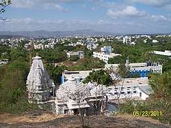 Mallinath Jain Tirth | |
 Kosbad Location in Maharashtra, India  Kosbad Kosbad (India) | |
| Coordinates: 20°00′55″N 72°45′21″E / 20.0153961°N 72.7557095°ECoordinates: 20°00′55″N 72°45′21″E / 20.0153961°N 72.7557095°E | |
| Country | India |
| State | Maharashtra |
| District | Palghar |
| Taluka | Dahanu |
| Elevation | 28 m (92 ft) |
| Population (2011) | |
| • Total | 4,479 |
| Time zone | UTC+5:30 (IST) |
| ISO 3166 code | IN-MH |
| 2011 census code | 551596 |
Kosbad is a village in the Palghar district of Maharashtra, India. It is located in the Dahanu taluka.[1]
Demographics
According to the 2011 census of India, Kosbad has 835 households. The effective literacy rate (i.e. the literacy rate of population excluding children aged 6 and below) is 59.12%.[2]
| Total | Male | Female | |
|---|---|---|---|
| Population | 4479 | 2239 | 2240 |
| Children aged below 6 years | 609 | 308 | 301 |
| Scheduled caste | 36 | 17 | 19 |
| Scheduled tribe | 4227 | 2127 | 2100 |
| Literates | 2288 | 1279 | 1009 |
| Workers (all) | 1917 | 1140 | 777 |
| Main workers (total) | 1560 | 990 | 570 |
| Main workers: Cultivators | 99 | 77 | 22 |
| Main workers: Agricultural labourers | 756 | 424 | 332 |
| Main workers: Household industry workers | 42 | 26 | 16 |
| Main workers: Other | 663 | 463 | 200 |
| Marginal workers (total) | 357 | 150 | 207 |
| Marginal workers: Cultivators | 103 | 46 | 57 |
| Marginal workers: Agricultural labourers | 186 | 68 | 118 |
| Marginal workers: Household industry workers | 11 | 3 | 8 |
| Marginal workers: Others | 57 | 33 | 24 |
| Non-workers | 2562 | 1099 | 1463 |
References
- ↑ "Maharashtra villages" (PDF). Land Records Information Systems Division, NIC. Retrieved 2015-08-17.
- 1 2 "District census data". 2011 Census of India. Directorate of Census Operations. Archived from the original on 2015-10-02. Retrieved 2015-08-17.
This article is issued from
Wikipedia.
The text is licensed under Creative Commons - Attribution - Sharealike.
Additional terms may apply for the media files.