Kortenhoef
| Kortenhoef | ||
|---|---|---|
| Town | ||
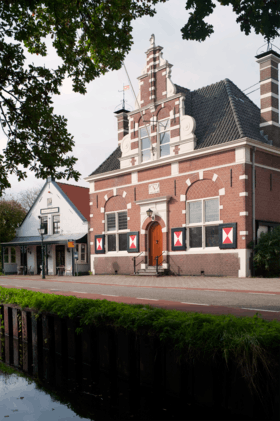 Rijksmonument, former town hall of Kortenhoef | ||
| ||
 | ||
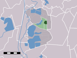 The town centre (darkgreen) and the statistical district (lightgreen) of Kortenhoef in the municipality of Wijdemeren. | ||
| Coordinates: 52°14′23″N 5°6′53″E / 52.23972°N 5.11472°ECoordinates: 52°14′23″N 5°6′53″E / 52.23972°N 5.11472°E | ||
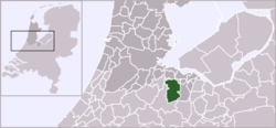
| Country | Netherlands | |
| Province |
| |
| Municipality | Wijdemeren | |
| Area | ||
| • Total | 14.89 km2 (5.75 sq mi) | |
| Population (2007) | ||
| • Total | 6,780 | |
| • Density | 460/km2 (1,200/sq mi) | |
| Time zone | UTC+1 (CET) | |
| • Summer (DST) | UTC+2 (CEST) | |

Kortenhoef is a town in North Holland, Netherlands with a population of about 6,780. It is an important part of the municipality of Wijdemeren, and lies about 5 km northwest of Hilversum. Kortenhoef was a separate municipality until 1966, when it was merged with 's-Graveland retaining the latter name;[1] it merged with Loosdrecht and Nederhorst den Berg to form the new municipality of Wijdemeren in 2002.
In 2001, the village of Kortenhoef had 5,548 inhabitants. The built-up area was 0.76 km², and contained 2174 residences.[2] The statistical district "Kortenhoef", which covers the village and the surrounding countryside, has a population of around 6250.[3]
Gallery
 De Karekiet
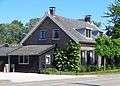 Fortwachterswoning
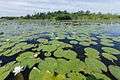 Kortenhoefse plassen
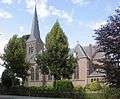 St. Anthony Church
References
- ↑ Ad van der Meer and Onno Boonstra, Repertorium van Nederlandse gemeenten, KNAW, 2006.
- ↑ Statistics Netherlands (CBS), Bevolkingskernen in Nederland 2001 "Archived copy". Archived from the original on 2006-03-19. Retrieved 2003-11-28. . Statistics are for the continuous built-up area.
- ↑ Statistics Netherlands (CBS), Statline: Kerncijfers wijken en buurten 2003-2005 . As of 1 January 2005.
External links
- J. Kuyper, Gemeente Atlas van Nederland, 1865-1870, "Kortenhoef". Map of the former municipality, around 1868.
This article is issued from
Wikipedia.
The text is licensed under Creative Commons - Attribution - Sharealike.
Additional terms may apply for the media files.