Korenica
| Korenica | |
|---|---|
| Municipality seat | |
 | |
 Korenica Location of Korenica | |
| Coordinates: 44°44′N 15°42′E / 44.733°N 15.700°E | |
| Country |
|
| Population (2011 census) | |
| • Total | 1,766 |
| Time zone | UTC+1 (CET) |
| • Summer (DST) | UTC+2 (CEST) |
| Area code(s) | +385 53 |
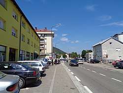
Korenica is a small town in Lika, Croatia, located in the municipality of Plitvička Jezera, on the road between Plitvice and Udbina. It has 1,766 residents (2011).[1]
In SFR Yugoslavia it was named Titova Korenica after Yugoslav leader Josip Broz Tito. The population consists of local ethnic Croats and Serbs, and there are also Croats from Bosnia who moved to Croatia after the Croatian War for Independence.
Korenica has one elementary school and one high school.
History
Until 1918, Korenica was part of the Austrian monarchy (Kingdom of Croatia-Slavonia, Lika-Krbava County) after the compromise of 1867), in the Croatian Military Frontier, administered by the Kommando OTTOTSCHANER Regiment N°II before 1881. A post-office was opened in 1862.[2]
Demographics
Historical population 1857-2011 [1][3]
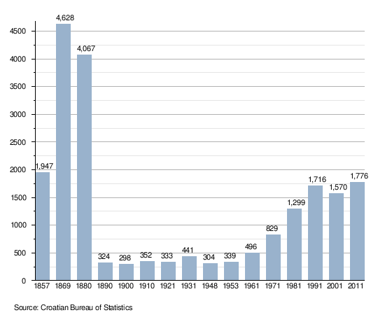
- NOTE: Population figures for the period 1857-1880 also include population figures for the following settlements: Drakulić Rijeka, Gradina Korenička, Homoljac, Jasikovac, Kalebovac, Kompolje Koreničko, Mihaljevac, Oravac, Ponor Korenički, Šeganovac, Vranovača and Vrpile.
Sights
- Site of the Monument to the fallen partisan soldiers and civilian victims of fascism during the National Liberation War (WWII) from the Lika region, in Bijeli Potoci (destroyed around 2008)[4]
See also
References
- 1 2 "Population by Age and Sex, by Settlements, 2011 Census: Korenica". Census of Population, Households and Dwellings 2011. Zagreb: Croatian Bureau of Statistics. December 2012.
- ↑ Handbook of Austria and Lombardy-Venetia Cancellations on the Postage Stamp Issues 1850-1864, by Edwin MUELLER, 1961.
- ↑ Naselja i stanovništvo Republike Hrvatske 1857-2001, www.dzs.hr
- ↑ "Spomenik Database - Central Monument of the White Streams (Bijeli Potoci) - Kamensko Memorial Area". spomenikdatabase.org. Retrieved 23 July 2018.
Coordinates: 44°44′36″N 15°42′23″E / 44.74333°N 15.70639°E