Konradsreuth
| Konradsreuth | ||
|---|---|---|
| ||
 Konradsreuth Location of Konradsreuth within Hof district 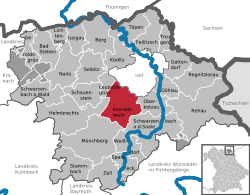 | ||
| Coordinates: 50°16′N 11°50′E / 50.267°N 11.833°ECoordinates: 50°16′N 11°50′E / 50.267°N 11.833°E | ||
| Country | Germany | |
| State | Bavaria | |
| Admin. region | Oberfranken | |
| District | Hof | |
| Government | ||
| • Mayor | Matthias Döhla (SPD) | |
| Area | ||
| • Total | 43.32 km2 (16.73 sq mi) | |
| Elevation | 552 m (1,811 ft) | |
| Population (2017-12-31)[1] | ||
| • Total | 3,178 | |
| • Density | 73/km2 (190/sq mi) | |
| Time zone | CET/CEST (UTC+1/+2) | |
| Postal codes | 95176 | |
| Dialling codes | 09292 | |
| Vehicle registration | HO | |
| Website | www.konradsreuth.de | |

Konradsreuth is a municipality in Upper Franconia in the district of Hof in Bavaria in Germany.
Geography
The districts
With the local government reorganization in 1972, the following villages were merged into Konradsreuth municipality:
| Ahornberg | Berg | Birkenhof | Brand | Eckardsreuth | Engel |
| Frauenhof | Föhrenreuth | Glänzlamühle | Gläsel | Gottschalk | Hollareuth |
| Jägerhaus | Klausenhof | Konradsreuth | Lerchenberg | Martinsreuth | Maschinenhaus (Waldlust) |
| Modlitz | Neudörflein | Oberpferdt | Pretschenreuth | Reuthlas | Ringlasmühle |
| Schallershof | Schallersreuth | Schwarzenfurth | Schödelshöhe | Silberbach | Steinmühle |
| Stiftsgrün | Unterpferdt | Walburgisreuth | Weißlenreuth | Wendlershof | Wölbersbach |
References
- ↑ "Fortschreibung des Bevölkerungsstandes". Bayerisches Landesamt für Statistik und Datenverarbeitung (in German). September 2018.
This article is issued from
Wikipedia.
The text is licensed under Creative Commons - Attribution - Sharealike.
Additional terms may apply for the media files.