Komaripalem
| Komaripalem | |
|---|---|
| Village | |
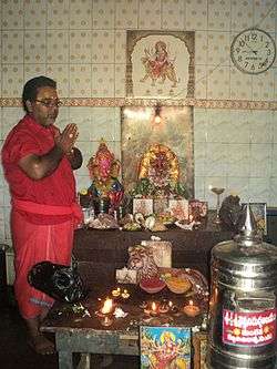 Durgamma Temple | |
 Komaripalem Location in Andhra Pradesh, India  Komaripalem Komaripalem (India) | |
| Coordinates: 16°55′23″N 82°00′18″E / 16.923°N 82.005°ECoordinates: 16°55′23″N 82°00′18″E / 16.923°N 82.005°E | |
| Country |
|
| State | Andhra Pradesh |
| District | East Godavari |
| Talukas | Biccavolu |
| Area[1] | |
| • Total | 6.85 km2 (2.64 sq mi) |
| Elevation | 13 m (43 ft) |
| Population (2011)[1] | |
| • Total | 6,479 |
| • Density | 950/km2 (2,400/sq mi) |
| Languages | |
| • Official | Telugu |
| Time zone | UTC+5:30 (IST) |
| PIN | 533346 |
| Telephone code | 08857 |
Komaripalem is a village in East Godavari district of the Indian state of Andhra Pradesh. It is located Biccavolu mandal of Rajahmundry revenue division.[1]
Geography
Komaripalem is located in Biccavolu Mandal, East Godavari District. It has an average elevation of 13 meters (42.65 feet).
Population
- Population: 6479
- Male: 3187
- Female: 3292[1]
References
- 1 2 3 4 "District Census Handbook – East Godavari" (PDF). Census of India. The Registrar General & Census Commissioner. pp. 16, 396. Retrieved 17 May 2017.
This article is issued from
Wikipedia.
The text is licensed under Creative Commons - Attribution - Sharealike.
Additional terms may apply for the media files.