Kolsdalen
| Kolsdalen | |
|---|---|
| Neighborhood in Kristiansand | |
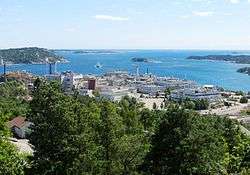 View of the neighborhood | |
 Kolsdalen Location of the neighborhood  Kolsdalen Kolsdalen (Norway) | |
| Coordinates: 58°08′22″N 7°57′58″E / 58.1394°N 07.9661°ECoordinates: 58°08′22″N 7°57′58″E / 58.1394°N 07.9661°E | |
| Country | Norway |
| County | Vest-Agder |
| Municipality | Kristiansand |
| Borough | Grim |
| District | Tinnheia |
| Time zone | UTC+01:00 (CET) |
| • Summer (DST) | UTC+02:00 (CEST) |
| Postal code | 4629 |
| Area code | 38 |
Kolsdalen is a neighbourhood in the city of Kristiansand in Vest-Agder county, Norway. It is located in the borough of Grim and in the district of Tinnheia. It lies along the European route E39 highway, south of Kolsberg and east of Hannevika.[1]
References
- ↑ "Kristiansand Kommune - Høietun". kristiansand.kommune.no. Retrieved 2015-01-01.
This article is issued from
Wikipedia.
The text is licensed under Creative Commons - Attribution - Sharealike.
Additional terms may apply for the media files.