Kolosovsky District
| Kolosovsky District Колосовский район (Russian) | |
|---|---|
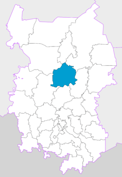 Location of Kolosovsky District in Omsk Oblast | |
| Coordinates: 56°27′52″N 73°36′41″E / 56.46444°N 73.61139°ECoordinates: 56°27′52″N 73°36′41″E / 56.46444°N 73.61139°E | |
 |
.png) |
|
| |
| Location | |
| Country | Russia |
| Federal subject | Omsk Oblast[1] |
| Administrative structure (as of December 2009) | |
| Administrative center | selo of Kolosovka[1] |
| Administrative divisions:[1] | |
| rural okrug | 11 |
| Inhabited localities:[1] | |
| Rural localities | 34 |
| Municipal structure (as of July 2011) | |
| Municipally incorporated as | Kolosovsky Municipal District[2] |
| Municipal divisions:[2] | |
| Urban settlements | 0 |
| Rural settlements | 11 |
| Statistics | |
| Area | 4,700 km2 (1,800 sq mi)[3] |
| Population (2010 Census) | 12,803 inhabitants[4] |
| • Urban | 0% |
| • Rural | 100% |
| Density | 2.72/km2 (7.0/sq mi)[5] |
| Time zone | OMST (UTC+06:00)[6] |
| Official website | |
| Kolosovsky District on WikiCommons | |
Kolosovsky District (Russian: Колосо́вский райо́н) is an administrative[1] and municipal[2] district (raion), one of the thirty-two in Omsk Oblast, Russia. It is located in the center of the oblast. The area of the district is 4,700 square kilometers (1,800 sq mi).[3] Its administrative center is the rural locality (a selo) of Kolosovka.[1] Population: 12,803 (2010 Census);[4] 15,763 (2002 Census);[7] 17,861 (1989 Census).[8] The population of Kolosovka accounts for 41.5% of the district's total population.[4]
References
Notes
- 1 2 3 4 5 6 Law #467-OZ
- 1 2 3 Law #548-OZ
- 1 2 "General Information" (in Russian). Kolosovsky District. Retrieved April 12, 2018.
- 1 2 3 Russian Federal State Statistics Service (2011). "Всероссийская перепись населения 2010 года. Том 1" [2010 All-Russian Population Census, vol. 1]. Всероссийская перепись населения 2010 года (2010 All-Russia Population Census) (in Russian). Federal State Statistics Service. Retrieved June 29, 2012.
- ↑ The value of density was calculated automatically by dividing the 2010 Census population by the area specified in the infobox. Please note that this value is only approximate as the area specified in the infobox does not necessarily correspond to the area of the entity proper or is reported for the same year as the population.
- ↑ Правительство Российской Федерации. Федеральный закон №107-ФЗ от 3 июня 2011 г. «Об исчислении времени», в ред. Федерального закона №271-ФЗ от 03 июля 2016 г. «О внесении изменений в Федеральный закон "Об исчислении времени"». Вступил в силу по истечении шестидесяти дней после дня официального опубликования (6 августа 2011 г.). Опубликован: "Российская газета", №120, 6 июня 2011 г. (Government of the Russian Federation. Federal Law #107-FZ of June 31, 2011 On Calculating Time, as amended by the Federal Law #271-FZ of July 03, 2016 On Amending Federal Law "On Calculating Time". Effective as of after sixty days following the day of the official publication.).
- ↑ Russian Federal State Statistics Service (May 21, 2004). "Численность населения России, субъектов Российской Федерации в составе федеральных округов, районов, городских поселений, сельских населённых пунктов – районных центров и сельских населённых пунктов с населением 3 тысячи и более человек" [Population of Russia, Its Federal Districts, Federal Subjects, Districts, Urban Localities, Rural Localities—Administrative Centers, and Rural Localities with Population of Over 3,000] (XLS). Всероссийская перепись населения 2002 года [All-Russia Population Census of 2002] (in Russian). Retrieved August 9, 2014.
- ↑ Demoscope Weekly (1989). "Всесоюзная перепись населения 1989 г. Численность наличного населения союзных и автономных республик, автономных областей и округов, краёв, областей, районов, городских поселений и сёл-райцентров" [All Union Population Census of 1989: Present Population of Union and Autonomous Republics, Autonomous Oblasts and Okrugs, Krais, Oblasts, Districts, Urban Settlements, and Villages Serving as District Administrative Centers]. Всесоюзная перепись населения 1989 года [All-Union Population Census of 1989] (in Russian). Институт демографии Национального исследовательского университета: Высшая школа экономики [Institute of Demography at the National Research University: Higher School of Economics]. Retrieved August 9, 2014.
Sources
- Законодательное Собрание Омской области. Закон №467-ОЗ от 15 октября 2003 г. «Об административно-территориальном устройстве Омской области и о порядке его изменения», в ред. Закона №1591-ОЗ от 10 декабря 2013 г. «О внесении изменений в отдельные Законы Омской области в связи с принятием Федерального Закона "Об образовании в Российской Федерации"». Вступил в силу через три месяца со дня официального опубликования. Опубликован: "Омский вестник", №69, 31 октября 2003 г. (Legislative Assembly of Omsk Oblast. Law #467-OZ of October 15, 2003 On the Administrative-Territorial Structure of Omsk Oblast and on the Procedures of Its Change, as amended by the Law #1591-OZ of December 10, 2013 On Amending Various Laws of Omsk Oblast Due to the Adoption of the Federal Law "On Education in the Russian Federation". Effective as of the day three months after the official publication date.).
- Законодательное Собрание Омской области. Закон №548-ОЗ от 30 июля 2004 г. «О границах и статусе муниципальных образований Омской области», в ред. Закона №1642-ОЗ от 27 июня 2014 г. «О внесении изменений в Закон Омской области "О границах и статусе муниципальных образований Омской области"». Вступил в силу со дня официального опубликования. Опубликован: "Омский вестник", №45, №47, №49, 13, 20, 27 августа 2004 г. (Legislative Assembly of Omsk Oblast. Law #548-OZ of July 30, 2004 On the Borders and Status of the Municipal Formations of Omsk Oblast, as amended by the Law #1642-OZ of June 27, 2014 On Amending the Law of Omsk Oblast "On the Borders and Status of the Municipal Formations of Omsk Oblast". Effective as of the day of the official publication.).
| Districts |
| ||
|---|---|---|---|
| Cities and towns | |||
| Urban-type settlements |
| ||
This article is issued from
Wikipedia.
The text is licensed under Creative Commons - Attribution - Sharealike.
Additional terms may apply for the media files.