Kokusaikaikan Station
Kokusaikaikan Station 国際会館駅 | |
|---|---|
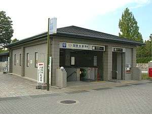 Entrance No. 3 of the station | |
| Location |
Sakyō-ku, Kyoto Japan |
| Operated by | Kyoto Municipal Transportation Bureau |
| Line(s) | Karasuma Line |
| Platforms | 1 island platform |
| Tracks | 2 |
| Other information | |
| Station code | K01 |
| History | |
| Opened | 3 June 1997 |
| Traffic | |
| Passengers (FY2016) | 25,932 daily[1] |
Kokusaikaikan Station (国際会館駅 Kokusai-Kaikan-eki) is a train station on the Kyoto Municipal Subway Karasuma Line in Sakyō-ku, Kyoto, Japan. It is the beginning of the line, and was opened on 3 June 1997.[2]
Lines
- Kyoto Municipal Subway Karasuma Line (Station Number: K01)
Layout
The station has an island platform serving two tracks.
| 1, 2 | ■ Karasuma Line | for Shijo, Kyoto, Takeda and Kintetsu Nara |
Adjacent stations
| « | Service | » | ||
|---|---|---|---|---|
| Kyoto Municipal Subway Karasuma Line (K01) | ||||
| Terminus | - | Matsugasaki (K02) | ||
Around the station
The station name "Kokusaikaikan" refers to the Kyoto International Conference Center (国立京都国際会館 Kokuritsu Kyōto Kokusai-kaikan), the city's main conference hall where many international conventions, including the conference that created the Kyoto Protocol in 1997, are held. The center can be accessed by short walk from the station.
- Kyoto International Conference Center
- Grand Prince Hotel Kyoto
- Iwakura Station (Eizan Railway Kurama Line)
- Entsu-ji
- Takaragaike-dori
- Doshisha Elementary School, Doshisha Junior and Senior High School
Bus stops
- Kokusaikaikan-ekimae
- Kyoto City Bus: Bus stop A
- Route 5 for Shijo Kawaramachi and Kyōto Station
- Route 31 for Gion and Shijo Karasuma
- Route 65 for Karasuma Marutamachi and Shijo Karasuma
- Kyoto City Bus: Bus stop B
- Route 5, 31, 65 for Iwakura Depot
- Kyoto Bus Co., Ltd.: Bus stop 1
- Route 24 for Iwakura Jisso-in
- Route 26 for Iwakura Muramatsu (part of buses run via Iwakura Shimozaichicho)
- Route 29 for Iwakura Muramatsu via Iwakura Shinozaichicho and Nagatani Hachimangu
- Route 45, 46 for Iwakura Muramatsu
- Kyoto Bus Co., Ltd.: Bus stop 2
- Route 40 for Kyoto Sangyo Daigaku-mae and Ichihara via Hokuryo Koko-mae, Kyoto Seika Daigaku-mae and Chikyuken-mae
- Route 45 for Kyoto Station, Entsujimichi and Hakuaikai Byoin-mae
- Route 46 for Kitaoji Station, Entsujimichi and Hakuaikai Byoin-mae
- Route 50 for Ichihara via Hokuryo Koko-mae, Kyoto Seika Daigaku-mae and Chikyuken-mae
- for Keihan Demachiyanagi Station via Hanazonobashi and Kawabata-dori (running only on weekdays)
- for Takano Depot via Takaragaike Kyugijo-mae (running except weekdays)
- Kyoto Bus Co., Ltd.: Bus stop 3
- Route 19 for Ohara and Kodeishi via Hanazonobashi and Yase ekimae
- Kyoto City Bus: Bus stop A
References
- ↑ "京都市交通事業白書" (in Japanese). Kyoto Municipal Transportation Bureau.
- ↑ Kyoto Municipal Transportation Bureau (May 29, 2015). "京都市交通局のあゆみ~年表(沿革)~". Archived from the original on October 11, 2008. Retrieved February 7, 2016.
External links
- Access map from Kokusaikaikan Station to ICC Kyoto (in English)
- Station information by City of Kyoto (in English)
Coordinates: 35°03′46″N 135°47′07″E / 35.0627°N 135.7854°E
This article is issued from
Wikipedia.
The text is licensed under Creative Commons - Attribution - Sharealike.
Additional terms may apply for the media files.