Kochel
| Kochel a.See | ||
|---|---|---|
| ||
 Kochel a.See Location of Kochel a.See within Bad Tölz-Wolfratshausen district 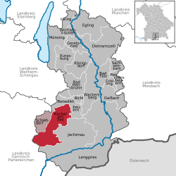 | ||
| Coordinates: 47°39′17″N 11°21′53″E / 47.65472°N 11.36472°ECoordinates: 47°39′17″N 11°21′53″E / 47.65472°N 11.36472°E | ||
| Country | Germany | |
| State | Bavaria | |
| Admin. region | Oberbayern | |
| District | Bad Tölz-Wolfratshausen | |
| Municipal assoc. | Kochel a.See | |
| Government | ||
| • Mayor | Thomas W. Holz | |
| Area | ||
| • Total | 80.12 km2 (30.93 sq mi) | |
| Elevation | 605 m (1,985 ft) | |
| Population (2017-12-31)[1] | ||
| • Total | 4,112 | |
| • Density | 51/km2 (130/sq mi) | |
| Time zone | CET/CEST (UTC+1/+2) | |
| Postal codes | 82431 | |
| Dialling codes | 08851 | |
| Vehicle registration | TÖL | |
| Website | www.kochel.de | |

Kochel am See is a municipality in the district of Bad Tölz-Wolfratshausen in Bavaria on the shores of Kochelsee. The municipality consists of the districts Altjoch, Brunnenbach, Ort, Pessenbach, Pfisterberg, Walchensee and Ried.[2]
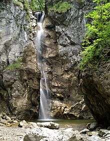

Apart from its scenery, the settlement is known for the Smith of Kochel "Schmied von Kochel", who, according to legend, lead a Bavarian farmer rebellion against Austro-Hungarian occupiers at Sendling in the War of the Spanish Succession. Kochel is also known for its hydroelectric dam. It is a popular place for winter and summer holidays.
The famous expressionist painter Franz Marc lived in Kochel. His life is documented at the Franz Marc museum in Kochel.[3] He is buried in the village cemetery.
Points of interest
References
- ↑ "Fortschreibung des Bevölkerungsstandes". Bayerisches Landesamt für Statistik und Datenverarbeitung (in German). September 2018.
- ↑ "Der Ort Kochel a. See" (in German). Retrieved 15 August 2016.
- ↑ "Franz Marc Museum". Retrieved 19 August 2012.
External links
- (in German) Kochel Homepage
![]()
Towns and municipalities in Bad Tölz-Wolfratshausen | ||
|---|---|---|