Klovningen
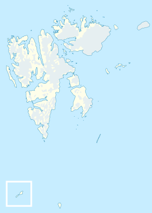
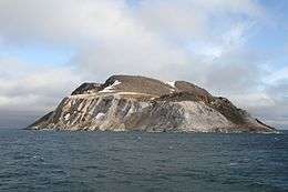 Photo from the outer northwestern sea inlet of Spitsbergen, called Fair Haven, with the islands Nordvestøyane and surroundings. Albert I Land, Spitsbergen, Svalbard (Norway). | |
 Klovningen | |
| Geography | |
|---|---|
| Coordinates | 79°52′00″N 11°30′00″E / 79.86667°N 11.50000°ECoordinates: 79°52′00″N 11°30′00″E / 79.86667°N 11.50000°E |
| Archipelago | Nordvestøyane |
| Area | 2.2 km2 (0.85 sq mi) |
| Highest point | 292 |
| Administration | |
|
Norway | |
Klovningen is an island in Albert I Land at Spitsbergen, Svalbard. It has an area of about 2.2 km², and is located in the archipelago of Nordvestøyane. Its highest peak is 292 m.a.s.l., and the island is recognizable by a sharp cleft which separates two summits in the northern part.[1][2]
References
- ↑ "Klovningen (Svalbard)". Norwegian Polar Institute. Retrieved 11 August 2013.
- ↑ Arctic Pilot: Sailing directions Svalbard–Jan Mayen. 7. Stavanger: The Norwegian Hydrographic Service and The Norwegian Polar Institute. 1988. p. 272. ISBN 82-90653-06-9.
This article is issued from
Wikipedia.
The text is licensed under Creative Commons - Attribution - Sharealike.
Additional terms may apply for the media files.