Klever Reichswald

The Klever Reichswald is an Imperial forest in North Rhine-Westphalia (Germany) between the Rivers Rhine and Meuse at the German Dutch border. The forest is located in the municipal territory of Kleve, Goch, Kranenburg and Bedburg-Hau. It is the largest coherent wooded area of the lower Rhine and the largest coherent public state forest of North Rhine-Westphalia with an area of 51 km2 (5100 ha).[1]
Landscape and forest
The Reichswald is located on the ridge of the lower Rhine, which was created by glaciers. In the ice age a range of hills were created which contrasts the flat Rhine plane since. 31 of the hills reach heights above 50 meters. One of the highest ones is the Rupenberg with 95 meters,[2] located at the eastern end of the Reichswad.
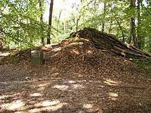
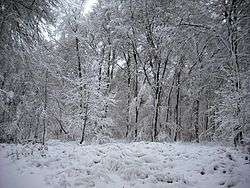
The forest is a closed mixed deciduous forest which is dominated by its copper beech population. For some areas the oak tree is predominant for some other parts conifer forest is found to be dominant.
In a westerly direction of the forest the Reichswald merges in woodland of the province Gelderland in the Netherlands. These are almost closed over the municipalities of Milsbeek, Mook en Middelaar, Berg en Dal and Heumen to Nijmegen.
Protected area
With the exception of small subareas the complete Reichswald is under landscape and nature protection. The majority can be found in areas of outstanding natural beauty: at AONB Waldgebiet Reichswald (ca. 3875 ha, in Kleve, Kranenburg and Goch), at AONB Reichswald (ca. 166 ha, in Bedburg-Hau) and at AONB Pfalzdorfer Höhenrand and Nierstal (only subareas at Reichswald, in Goch). The northern forest areas near the core of Kleve could be counted to the Reichswald as well. They are located at AONB Standortübungsplatz einschließlich der Umgebung westlich Kleve (ca. 126 ha) and at AONB Waldgebiet des Tiergartenwaldes (ca. 295 ha).
In the northwest area of the Reichswald the protected areas 'Quellen am Stoppelberg' is located (ca. 2,9 ha, in Kleve[3]) and in the middle of the forest the protected area ‘Geldernberg’ (ca. 580 ha, in Kleve, Kranenburg and Goch[4]) is located. ‘Geldernberg’ is known as the core area of the Reichswald and is stated as the FFH-Area DE-4202-302 Reichswald which makes it belong to the European network of protected areas Natura 2000. The AONB Geldenberg is of particular importance because it is the largest, largely closed, predominant hardwood old-growth forest in the Reichswald[4] and is home to endangered species like the golden oriole, black woodpecker, honey buzzard and stag beetle.
History
In the Second World War, Klever Reichswald was the location of the Battle of the Reichswald, also known as Operation Veritable, in February and March 1945. In this protracted battle against British and Canadian troops on Germany's Western Front, German lines under the capable General Alfred Schlemm (of the Luftwaffe) had been reequipped. The Siegfried Line was the most fortified in this area, and the troops were re-enforced by elite and experienced soldiers well prepared for protracted fighting.
Military manpower
The terrain largely nullified the Anglo-Canadians' advantages in equipment, armament and munitions, and manpower. On the German side, over 90,000 men fought in this battle, and 52,000 were taken prisoner. [5] On the Anglo-Canadian side, nearly 200,000 men were engaged in the fighting, with 23,000 casualties.[6]
Geology
As the Reichswald is on a glacial ridge, it is not subjected to flooding. The glacial gravel contains a lot of loam from the northern German plain and this causes the surface to become extremely muddy when using the unmetalled roads during a rainy period.
Notes
- ↑ City Cleve: The Reichswald
- ↑ see Photo of the marking stone with inscription „95 m“
- ↑ KLE-042 Quellen am Stoppelberg Nature Reserve in the information system of the NRW State Office for Nature, the Environment and Consumer Protection.
- 1 2 KLE-043 Geldenberg Nature Reserve in the information system of the NRW State Office for Nature, the Environment and Consumer Protection.
- ↑ "Battle of the Rhineland". The Canadian Encyclopedia. Retrieved 15 July 2009.
- ↑ Fowler, T. Robert (1995). "Operation Veritable". The 3rd Canadian Infantry Division in the Rhineland. General Store Publishing House. Retrieved 2007-12-28.
| Wikimedia Commons has media related to Klever Reichswald. |