Kitak
 Kitak | |
| Geography | |
|---|---|
| Location | North Atlantic |
| Coordinates | 65°32′N 38°46′W / 65.533°N 38.767°WCoordinates: 65°32′N 38°46′W / 65.533°N 38.767°W |
| Archipelago | Kitak group |
| Major islands | Kitak, Orssuiagssuaq, Igssalik |
| Length | 10.2 km (6.34 mi) |
| Width | 4.3 km (2.67 mi) |
| Highest elevation | 200 m (700 ft) |
| Administration | |
|
Greenland | |
| Municipality | Sermersooq |
| Demographics | |
| Population | uninhabited |
Kitak is an island in the Sermersooq municipality in southeastern Greenland.
In 1961 the German weather ship WBS 11 Hessen was renamed 'Kitak'.[1]
Geography
The island is located on the western side of the entrance of the Sermilik Fjord. There is a sheltered bay in the NW side of Kitak that is reportedly a good anchorage for ocean-going vessels.[2] The island is 10.2 kilometres (6 miles) long with maximum width of 4.3 kilometres (3 miles).[3]
Kitak is the largest and easternmost island of a compact cluster of coastal islands, islets and rocks extending for 14 km from the easternmost point of Kitak to the 51 m high islet of Igssalik in the west; 2.2 kilometres (1 mile) long Orssuiagssuaq, where formerly a LORAN station was located, is the southernmost island. The archipelago is separated from the mainland by narrow sounds, one of which is named 'Ikasartik'. The Suunikajik island cluster is located 4 km to the west.[4]
The nearest inhabited settlement is Tasiilaq, the most populous community on the eastern coast and the seventh-largest town in Greenland, located on Ammassalik Island on the other side of the fjord about 40 km to the ENE.
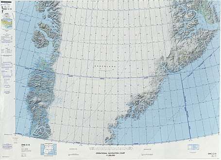 Map of Greenland section. |
References
- ↑ Ishavsmuseet Aarvak - Skutearkiv - "Kitak"
- ↑ Prostar Sailing Directions 2005 Greenland and Iceland Enroute, p. 101
- ↑ GoogleEarth
- ↑ Mapcarta Kitak