Kinbrace
Kinbrace
| |
|---|---|
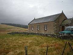 Kinbrace Church | |
 Kinbrace Kinbrace shown within the Sutherland area | |
| OS grid reference | NC862317 |
| Council area | |
| Country | Scotland |
| Sovereign state | United Kingdom |
| Post town | Kinbrace |
| Postcode district | KW11 |
| Police | Scottish |
| Fire | Scottish |
| Ambulance | Scottish |
| EU Parliament | Scotland |
| UK Parliament | |
| Scottish Parliament | |
Kinbrace is a small village in Sutherland in the Highland council area of Scotland. It lies at the junction of the A897 and B871[1] and is 17 miles (27 km) from Helmsdale by road.[2] The village has a station on the Far North Line (also named Kinbrace), and a primary school.[3] Few people live in the village with the population standing at 828,[4][5] although this statistic covers a much larger area than Kinbrace itself.
The village is represented in the House of Commons of the United Kingdom constituency of Caithness, Sutherland and Easter Ross, where it is represented by Jamie Stone, of the Scottish Liberal Democrats. It is represented in the Scottish Parliament by Rob Gibson, also of the Scottish National Party.
Railway station
Climate
As with the rest of the British Isles and Scotland, Kinbrace experiences a maritime climate with mild summers and cool winters. It is nonetheless one of the more frost prone locations in the country, with notable temperatures including a minimum of −21.7 °C (−7.1 °F) during March 2001,[6] and a daytime maximum of −10.5 °C (13.1 °F) during November 1985,[7] when a temperature inversion persisted throughout the day.
| Climate data for Kinbrace, 103m amsl, 1971-2000 | |||||||||||||
|---|---|---|---|---|---|---|---|---|---|---|---|---|---|
| Month | Jan | Feb | Mar | Apr | May | Jun | Jul | Aug | Sep | Oct | Nov | Dec | Year |
| Record high °C (°F) | 12.3 (54.1) |
13.4 (56.1) |
17.7 (63.9) |
23.6 (74.5) |
27.1 (80.8) |
28.6 (83.5) |
29.5 (85.1) |
29.1 (84.4) |
25.4 (77.7) |
20.8 (69.4) |
16.1 (61) |
13.0 (55.4) |
29.5 (85.1) |
| Average high °C (°F) | 5.2 (41.4) |
5.8 (42.4) |
7.7 (45.9) |
10.1 (50.2) |
13.5 (56.3) |
15.7 (60.3) |
17.9 (64.2) |
17.4 (63.3) |
14.6 (58.3) |
11.4 (52.5) |
7.6 (45.7) |
5.7 (42.3) |
11.1 (52) |
| Average low °C (°F) | −1.3 (29.7) |
−1.3 (29.7) |
0.1 (32.2) |
1.4 (34.5) |
3.6 (38.5) |
6.2 (43.2) |
8.7 (47.7) |
8.3 (46.9) |
6.3 (43.3) |
4.0 (39.2) |
1.0 (33.8) |
−0.8 (30.6) |
3.1 (37.6) |
| Record low °C (°F) | −20.3 (−4.5) |
−24.8 (−12.6) |
−21.7 (−7.1) |
−10.2 (13.6) |
−6.3 (20.7) |
−4.0 (24.8) |
−1.8 (28.8) |
−2.6 (27.3) |
−5.1 (22.8) |
−9.4 (15.1) |
−19.6 (−3.3) |
−25.5 (−13.9) |
−25.5 (−13.9) |
| Average precipitation mm (inches) | 111.6 (4.394) |
75.5 (2.972) |
88.2 (3.472) |
61.1 (2.406) |
51.6 (2.031) |
56.8 (2.236) |
63.9 (2.516) |
67.6 (2.661) |
91.5 (3.602) |
103.8 (4.087) |
117.7 (4.634) |
104.5 (4.114) |
993.8 (39.126) |
| Average precipitation days | 17.7 | 14.0 | 16.8 | 13.4 | 10.4 | 11.3 | 10.6 | 14.3 | 14.7 | 16.5 | 18.4 | 18.7 | 153.8 |
| Source: Met Office[8] | |||||||||||||
Notable people
- Angus Ross died in Kinbrace
References
- ↑ OpenStreetMap and other cartographs
- ↑ Ordnance Survey, 1:250,000 scale raster (2010)
- ↑ Helmsdale Community website's page on Kinbrace
- ↑ Scottish Neighbourhood Statistics, data zone S01003968
- ↑ Population estimate is based on the 2001 Census
- ↑ "2001 temperature". TORRO.
- ↑ "1985 Temperature". MetOffice. Archived from the original on 2012-02-06.
- ↑ "Kinbrace 1971-2000 averages". Met Office. Archived from the original on 2011-10-19. Retrieved 1 Nov 2011.