Kimbolton, Herefordshire
| Kimbolton | |
|---|---|
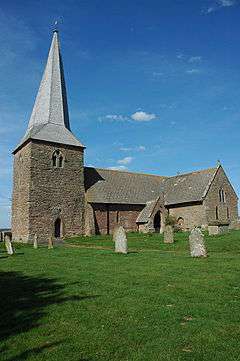 St James the Great Church, Kimbolton | |
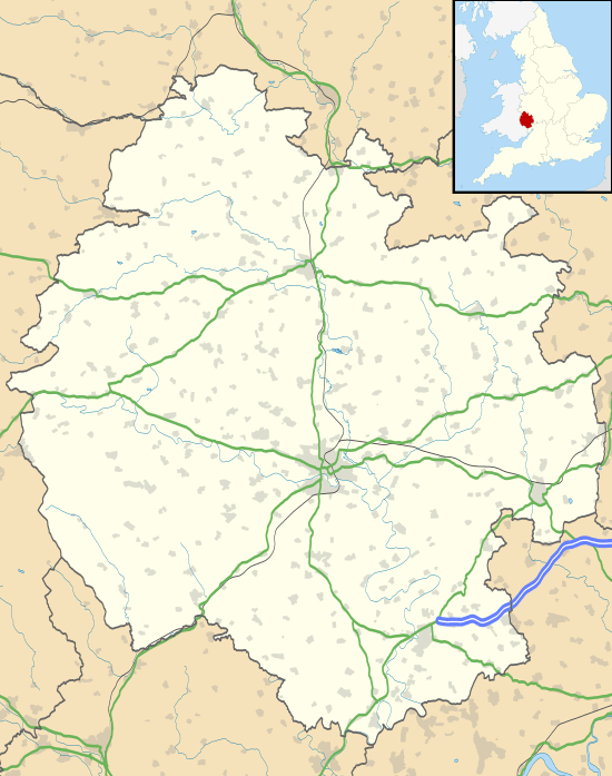 Kimbolton Kimbolton shown within Herefordshire | |
| Population | 472 |
| Unitary authority | |
| Ceremonial county | |
| Region | |
| Country | England |
| Sovereign state | United Kingdom |
| Post town | Leominster |
| Postcode district | HR6 |
| Dialling code | 01568 |
| Police | West Mercia |
| Fire | Hereford and Worcester |
| Ambulance | West Midlands |
| EU Parliament | West Midlands |
| UK Parliament | |
Kimbolton is a village and parish in Herefordshire, England, around 3 miles (5 km) north east of Leominster and 15 miles (24 km) north of Hereford. The village is on the A4112 road, near its junction with the A49 road. [1] The church is dedicated to St James, has 13th-century features and has two Norman windows in the chancel. The spire is shingled.[2]
Bath Camp, a small Iron Age hill fort, lies on a ridge above the Whyte Brook about 1.5 miles (2 km) south east of the church.[2][3]
The parish had a population in mid-2010 of 434,[4] increasing to 472 at the 2011 Census.[5]
References
- ↑ https://maps.google.co.uk/maps?hl=en&safe=off&q=kimbolton,+herefordshire&ie=UTF-8&ei=j-UsUMPdE8TmtQb1hIHIAg&ved=0CFMQ_AUoAg
- 1 2 Pevsner, Nikolaus (1963). The Buildings of England - Herefordshire. Yale University Press. p. 204. ISBN 978-0300096095.
- ↑ Leominster and Bromyard (Explorer Maps) (A1 ed.), Ordnance Survey, 2006, ISBN 9780319237595
- ↑ "Mid-2010 Civil Parish SYOA population estimates for England and Wales" (xls). Office for National Statistics.
- ↑ "Civil Parish population 2011". Retrieved 31 October 2015.
This article is issued from
Wikipedia.
The text is licensed under Creative Commons - Attribution - Sharealike.
Additional terms may apply for the media files.