Kilombero District
Kilombero District[1] is a district in Morogoro Region, south-western Tanzania.
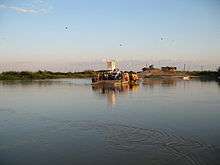
The district is situated in a vast floodplain, between the Kilombero River in the south-east and the Udzungwa-Mountains in the north-west. On the other side of the Kilombero River, in the south-east, the floodplain is part of Ulanga District.
According to the last census in 2002, the population of Kilombero District is 321,611 [2] The main ethnic groups are Wapogoro, Wandamba, Wabena, and Wambunga and several others in small proportions.[3]
The area is predominantly rural with the semi-urban district headquarters Ifakara as major settlement.
The majority of the villagers are subsistence farmers of maize and rice. There are large plantations of teak wood in the Kilombero and the neighbouring Ulanga districts. In the north-west of the district, Illovo Sugar Company's sugar-cane plantations occupy most of the lowlying area.[4][5][6]
Administrative subdivisions
Constituencies
For parliamentary elections, Tanzania is divided into constituencies. As of the 2010 elections Kilombrero District had one constituency:[7]
- Kilombrero Constituency
Divisions
Ifakara, Kidatu, Mang´ula,Mlimba, Mngeta.
Wards
| Chisano | Kiberege | Masagati | Mofu | |||
| Chita | Kidatu | Mbingu | Sanje | |||
| Idete | Kisawasawa | Mchombe | Uchindile | |||
| Ifakara | Lumemo | Mkula | Utengule | |||
| Kibaoni | Mang'ula | Mlimba | Msolwa Station | |||
| Mang'ula B | Mwaya | Signal | Michenga | |||
| Katindiuka | Mlabani | Viwanja sitini | Lipangalala | |||
| Namwawala | Mngeta | Igima | Mbasa | Ching'anda | Kalengakelo | Kamwene |
NGOs
- MSABI - Safe Water for Better Health Ifakara is an NGO that focuses on water, sanitation, hygiene, and education programs
- Friends of Kilombero
SAVE EDUCATION AND FUTURE DEVELOPMENT FOUNDATION - deals with promotion of access of quality education to the rural communities
References
- ↑ Kilombero District (Approved) at GEOnet Names Server, United States National Geospatial-Intelligence Agency
- ↑ "2002 Population and Housing Census General Report: Morogoro: Kilombero". Archived from the original on February 11, 2005.
- ↑ "Morogoro Region Socio-Economic Profile" (pdf). The Planning Commission, Dar es Salaam, and The Regional Commissioner's Office, Morogoro. 1997. Archived (PDF) from the original on 30 May 2004.
- ↑ Corti, Graham, Fanning, Eibleis, Hinde, Roy, and Jenkins, Richard, 1999. A Conservation Assessment the Amphibian Communities of Miombo Woodland, Evergreen Forest and a Teak (I'ectona Grandis) Plantation in the Ulanga Valley, Tanzania (Technical Report 3). Frontier-Tanzania Savanna Research Programme, Dar es Salaaml
- ↑ Hinde, R., Corti, G., Fanning, E., & Jenkins, R., 1999a, A conservation assessment of large mammal use of miombo woodland, evergreen forest and a teak plantation in the Ulanga Valley, Tanzania, Frontier Tanzania Savanna Research Programme, Technical Report No. 2., unpublished, Frontier Tanzania, Dar es Salaam, Tanzania.
- ↑ Jenkins R., Roettcher, K, Corti, G & Fanning, E, 2000a, Large mammals and teak plantations in the Ulanga Valley, Annual Report, unpublished, Frontier Tanzania, Dar es Salaam, Tanzania.
- ↑ "Organisations located in Kilombrero District - Tanzania". African Development Information. Archived from the original on 2012-09-03.