Kilmanagh, Michigan
| Kilmanagh, Michigan | |
|---|---|
| Unincorporated community | |
 Kilmanagh Location within the state of Michigan  Kilmanagh Kilmanagh (the US) | |
| Coordinates: 43°45′22″N 83°21′25″W / 43.75611°N 83.35694°WCoordinates: 43°45′22″N 83°21′25″W / 43.75611°N 83.35694°W | |
| Country | United States |
| State | Michigan |
| County | Huron |
| Townships |
Brookfield Sebewaing Fairhaven Winsor |
| Government | |
| • Type | none |
| Elevation | 614 ft (187 m) |
| Population (2000) | |
| • Total | ~30 |
| • Density | 90.3/sq mi (34.9/km2) |
| Time zone | UTC-5 (Eastern (EST)) |
| • Summer (DST) | UTC-4 (EDT) |
| ZIP code | 48759 (Sebewaing) |
| Area code(s) | 989 |
| GNIS feature ID | 629666[1] |
Kilmanagh is an unincorporated community in Huron County in the U.S. state of Michigan. The community is situated at 43°45′22″N 83°21′25″W / 43.75611°N 83.35694°W.[1] at the corners of four townships:
- Brookfield Township (northwest corner)
- Sebewaing Township (northeast corner)
- Fairhaven Township (southeast corner)
- Winsor Township (southwest corner)
History
Kilmanagh was first called Thompson's Corners, for Francis Thompson, an Irish homesteader who arrived in 1861. The name Kilmanagh was first used to describe the nearby Shebeon Creek, which would overflow each spring. A post office named Kilmanagh operated from February 1873 until June 1904.[2]
Government
School District serving the community are Elkton-Pigeon-Bay Port Schools and Owendale-Gagetown Area Schools.[3] The community is served by the Sebewaing based Post Office, Zip Code 48759.
| District | Number | Officeholder |
|---|---|---|
| U.S. Representative | 10 [4] | Candice Miller |
| State Senate | 31[5] | Mike Green |
| State Representative | 84[6] | Jacob Engelhardt |
| County Commissioner |
References
- 1 2 U.S. Geological Survey Geographic Names Information System: Kilmanagh, Michigan
- ↑ Romig, Walter (1986) [1973]. Michigan Place Names. Detroit, Michigan: Wayne State University Press. ISBN 0-8143-1838-X.
- ↑ "Huron County School District Map" (PDF). Michigan Boundary Maps. State of Michigan Department of Information Technology Technology Michigan Center for Geographic Information. May 2002. Retrieved 2009-07-09.
- ↑ "2001 Congressional District Statewide Map" (PDF). Michigan Boundary Maps. State of Michigan Department of Information Technology Technology Michigan Center for Geographic Information. September 2002. Retrieved 2009-07-09.
- ↑ "2001 Senate District Statewide Map" (PDF). Michigan Boundary Maps. State of Michigan Department of Information Technology Technology Michigan Center for Geographic Information. May 2002. Retrieved 2009-07-09.
- ↑ "Michigan's 110 House Districts 2001 Apportionment Plan" (PDF). Michigan Boundary Maps. State of Michigan Department of Information Technology Technology Michigan Center for Geographic Information. May 2002. Retrieved 2009-07-09.
Municipalities and communities of Huron County, Michigan, United States | ||
|---|---|---|
| Cities | 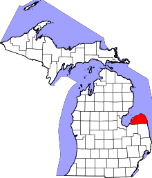 | |
| Villages | ||
| Townships | ||
| CDP | ||
| Other unincorporated communities | ||
This article is issued from
Wikipedia.
The text is licensed under Creative Commons - Attribution - Sharealike.
Additional terms may apply for the media files.