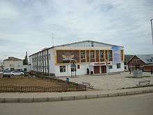
Khujirt
| Khujirt District Хужирт сум ᠬᠤᠵᠢᠷᠲᠤᠰᠤᠮᠤ | |
|---|---|
| District | |
 Khujirt District | |
| Coordinates: 46°53′51″N 102°46′0″E / 46.89750°N 102.76667°ECoordinates: 46°53′51″N 102°46′0″E / 46.89750°N 102.76667°E | |
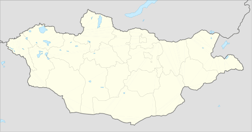
| Country | Mongolia |
| Province | Övörkhangai Province |
| Time zone | UTC+8 (UTC + 8) |
Khujirt
Khujirt (Mongolian: Хужирт) is a sum (district) of Övörkhangai Province in central Mongolia. The total population of the sum in 2008 was 6,649.[1]
Climate
Khujirt has a subarctic climate (Köppen climate classification Dwc) with mild summers and severely cold winters. Most precipitation falls in the summer as rain, with some snow in the adjacent months of May and September. Winters are very dry.
| Climate data for Khujirt | |||||||||||||
|---|---|---|---|---|---|---|---|---|---|---|---|---|---|
| Month | Jan | Feb | Mar | Apr | May | Jun | Jul | Aug | Sep | Oct | Nov | Dec | Year |
| Record high °C (°F) | 6.0 (42.8) |
11.0 (51.8) |
18.0 (64.4) |
25.9 (78.6) |
28.0 (82.4) |
32.0 (89.6) |
31.7 (89.1) |
32.3 (90.1) |
26.7 (80.1) |
23.6 (74.5) |
15.1 (59.2) |
11.7 (53.1) |
32.3 (90.1) |
| Average high °C (°F) | −12.6 (9.3) |
−8.8 (16.2) |
−0.1 (31.8) |
8.7 (47.7) |
16.4 (61.5) |
20.6 (69.1) |
21.3 (70.3) |
20.0 (68) |
15.4 (59.7) |
8.2 (46.8) |
−2.5 (27.5) |
−10.5 (13.1) |
6.3 (43.4) |
| Daily mean °C (°F) | −20.8 (−5.4) |
−17.9 (−0.2) |
−8.5 (16.7) |
0.4 (32.7) |
8.1 (46.6) |
13.0 (55.4) |
14.5 (58.1) |
12.8 (55) |
6.9 (44.4) |
−0.7 (30.7) |
−10.8 (12.6) |
−18.5 (−1.3) |
−1.8 (28.8) |
| Average low °C (°F) | −27.7 (−17.9) |
−25.8 (−14.4) |
−16.7 (1.9) |
−6.8 (19.8) |
0.2 (32.4) |
5.4 (41.7) |
8.0 (46.4) |
6.3 (43.3) |
−0.4 (31.3) |
−7.3 (18.9) |
−18.1 (−0.6) |
−24.9 (−12.8) |
−9 (15.8) |
| Record low °C (°F) | −41.3 (−42.3) |
−40.2 (−40.4) |
−35.8 (−32.4) |
−24.3 (−11.7) |
−12.8 (9) |
−5.1 (22.8) |
−1.6 (29.1) |
−4.5 (23.9) |
−16.7 (1.9) |
−26.0 (−14.8) |
−36 (−33) |
−41.8 (−43.2) |
−41.8 (−43.2) |
| Average precipitation mm (inches) | 1.1 (0.043) |
1.8 (0.071) |
3.7 (0.146) |
9.6 (0.378) |
23.7 (0.933) |
53.8 (2.118) |
60.4 (2.378) |
64.7 (2.547) |
25.0 (0.984) |
9.0 (0.354) |
3.3 (0.13) |
2.0 (0.079) |
258.1 (10.161) |
| Average precipitation days (≥ 1.0 mm) | 0.2 | 0.5 | 1.3 | 3.2 | 4.8 | 8.8 | 12.1 | 11.2 | 5.1 | 2.1 | 1.1 | 0.7 | 51.1 |
| Mean monthly sunshine hours | 196.4 | 210.7 | 261.5 | 252.9 | 283.0 | 272.8 | 260.2 | 250.0 | 250.3 | 238.5 | 196.0 | 176.3 | 2,848.6 |
| Source: NOAA (1961-1990) [2] | |||||||||||||
External links
| Wikimedia Commons has media related to Khujirt. |
References
- ↑ "Övörkhangai Aimag Sums Statistics, 2009" (PDF). Archived from the original (PDF) on April 21, 2012. Retrieved January 14, 2013.
- ↑ "Khujirt Climate Normals 1961-1990". National Oceanic and Atmospheric Administration. Retrieved January 14, 2013.
This article is issued from
Wikipedia.
The text is licensed under Creative Commons - Attribution - Sharealike.
Additional terms may apply for the media files.