Khôr ‘Angar
| Khôr ‘Angar خور أنغار | |
|---|---|
| Town | |
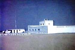 The Khôr ‘Angar Old Fort in 1969. | |
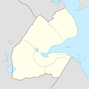 Khôr ‘Angar Location in Djibouti. | |
| Coordinates: 12°23′N 43°20′E / 12.383°N 43.333°ECoordinates: 12°23′N 43°20′E / 12.383°N 43.333°E | |
| Country |
|
| Region | Obock |
| Elevation | 10 m (30 ft) |
| Population (2017) | |
| • Total | 3,500 |
Khôr ‘Angar (Arabic: خور أنغار) is a town in the northern Obock Region of Djibouti. It is situated on the west coast of the Bab el Mandeb Strait. The town is home to an airstrip.
Overview
Khôr ‘Angar is located in west coast of the Bab el Mandeb Strait and in the north-east of the Republic of Djibouti, 296 km (184 mi) (by road) of Djibouti City.
Climate
The warmest month of the year is July with an average temperature of 34.9 °C. An annual low is reached in January, when the average temperature is 26.3 °C.[1] The difference in precipitation between the driest and wettest month is 9 mm. The average temperatures vary during the year by 8.6 °C. The sky is always clear and bright throughout the year.
| Climate data for Khôr ‘Angar | |||||||||||||
|---|---|---|---|---|---|---|---|---|---|---|---|---|---|
| Month | Jan | Feb | Mar | Apr | May | Jun | Jul | Aug | Sep | Oct | Nov | Dec | Year |
| Average high °C (°F) | 29.8 (85.6) |
29.8 (85.6) |
31.4 (88.5) |
33.2 (91.8) |
35.8 (96.4) |
38.2 (100.8) |
39.8 (103.6) |
39.0 (102.2) |
37.1 (98.8) |
34.4 (93.9) |
31.8 (89.2) |
30.3 (86.5) |
34.2 (93.6) |
| Average low °C (°F) | 22.8 (73) |
23.4 (74.1) |
24.4 (75.9) |
25.8 (78.4) |
27.9 (82.2) |
30.0 (86) |
30.0 (86) |
29.4 (84.9) |
29.5 (85.1) |
26.5 (79.7) |
24.4 (75.9) |
23.3 (73.9) |
26.5 (79.6) |
| Average rainfall mm (inches) | 5 (0.2) |
4 (0.16) |
8 (0.31) |
3 (0.12) |
1 (0.04) |
0 (0) |
4 (0.16) |
6 (0.24) |
9 (0.35) |
4 (0.16) |
7 (0.28) |
6 (0.24) |
57 (2.26) |
| Source: Climate-Data.org, altitude: 10m[1] | |||||||||||||
Notes
- 1 2 "Climate: Khôr 'Angar - Climate graph, Temperature graph, Climate table". Climate-Data.org. Retrieved 25 September 2013.
References
External links
This article is issued from
Wikipedia.
The text is licensed under Creative Commons - Attribution - Sharealike.
Additional terms may apply for the media files.