Khong District, Nakhon Ratchasima
| Khong คง | |
|---|---|
| Amphoe | |
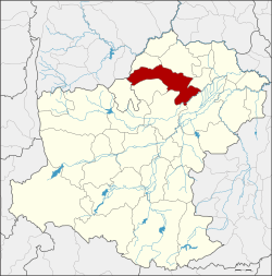 Amphoe location in Nakhon Ratchasima Province | |
| Coordinates: 15°26′29″N 102°19′43″E / 15.44139°N 102.32861°ECoordinates: 15°26′29″N 102°19′43″E / 15.44139°N 102.32861°E | |
| Country | Thailand |
| Province | Nakhon Ratchasima |
| Seat | Mueang Khong |
| Area | |
| • Total | 454.7 km2 (175.6 sq mi) |
| Population (2000) | |
| • Total | 81,484 |
| • Density | 179.2/km2 (464/sq mi) |
| Time zone | UTC+7 (ICT) |
| Postal code | 30260 |
| Geocode | 3004 |
Khong (Thai: คง, pronounced [kʰōŋ]) is a district (amphoe) in the northern part of Nakhon Ratchasima Province, northeastern Thailand.
History
The name of the district originates from the founding legend of its main settlement. A hunter named Khong was the pioneer of the town. He invited people to settle the new town in this fertile land. The people named the town name him Mueang Khong. Later the government removed Mueang from the district name to prevent confusion with Amphoe Mueang.
The area became a sub-district (king amphoe) of Bua Yai District in 1938. It was upgraded to a full district in 1947.
Geography
Neighboring districts are (from the north clockwise) Ban Lueam, Bua Yai, Non Daeng, Phimai, Non Sung, Kham Sakaesaeng, and Phra Thong Kham of Nakhon Ratchasima Province, and Noen Sa-nga of Chaiyaphum Province.
Administration
The district is divided into 10 sub-districts (tambon). There are two townships (thesaban tambon), Mueang Khong and Thephalai, each covering part of the same-named tambon.
| 1. | Mueang Khong | เมืองคง | |
| 2. | Khu Khat | คูขาด | |
| 3. | Thephalai | เทพาลัย | |
| 4. | Ta Chan | ตาจั่น | |
| 5. | Ban Prang | บ้านปรางค์ | |
| 6. | Nong Manao | หนองมะนาว | |
| 7. | Nong Bua | หนองบัว | |
| 8. | Non Teng | โนนเต็ง | |
| 9. | Don Yai | ดอนใหญ่ | |
| 10. | Kham Sombun | ขามสมบูรณ์ |