Khan Na Yao District
| Khan Na Yao คันนายาว | |
|---|---|
| Khet | |
_W.jpg) Slider and swimming pool of Siam Park City | |
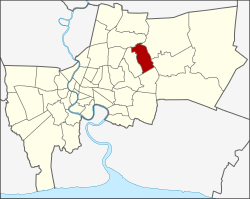 Khet location in Bangkok | |
| Country | Thailand |
| Province | Bangkok |
| Seat | Khan Na Yao |
| Khwaeng | 2 |
| Khet established | 21 November 1997 |
| Area | |
| • Total | 25.980 km2 (10.031 sq mi) |
| Population (2017) | |
| • Total | 96,751[1] |
| • Density | 3,724.05/km2 (9,645.2/sq mi) |
| Time zone | UTC+7 (ICT) |
| Postal code | 10230 |
| Geocode | 1043 |
Khan Na Yao (Thai: คันนายาว, pronounced [kʰān nāː jāːw]) is one of the 50 districts (khet) of Bangkok, Thailand. It is bounded by other Bangkok districts (from north clockwise): Bang Khen, Khlong Sam Wa, Min Buri, Saphan Sung, and Bueng Kum.
History
Khan Na Yao was separated from Bueng Kum on 14 October 1997 announcement, effective 21 November 1997, together with Saphan Sung.[2]
Its name meaning "long paddy-field ridge" for describing the majority geography of the district. Khan Na Yao is the agricultural district.
Places
- Wat Rassattadhum
- Siam Park City
- Fashion Island
- Bangchan Industrial Estate
Administration
The district is divided into two sub-districts (khwaeng).
| 1. | Khan Na Yao | คันนายาว | |
| 2. | Ram Inthra | รามอินทรา |
District council
The District Council for Khan Na Yao has seven members, who each serve four-year terms. Elections were last held on 30 April 2006. The Thai Rak Thai Party won seven seats.
References
- ↑ "Population and House Report for Year 2017 (see page 2 for data of this district)". Department of Provincial Administration, Ministry of Internal Affairs. Retrieved 2018-04-01. (Search page)
- ↑ ประกาศกระทรวงมหาดไทย เรื่อง เปลี่ยนแปลงพื้นที่เขตบางเขน เขตลาดพร้าว เขตบึงกุ่ม เขตประเวศ และตั้งเขตสายไหม เขตคันนายาว เขตสะพานสูง (PDF). Royal Gazette (in Thai). 114 (พิเศษ 108 ง): 6. 1997-11-18.
External links
.svg.png)
This article is issued from
Wikipedia.
The text is licensed under Creative Commons - Attribution - Sharealike.
Additional terms may apply for the media files.