Khai Bang Rachan District
| Khai Bang Rachan ค่ายบางระจัน | |
|---|---|
| Amphoe | |
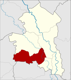 Amphoe location in Singburi Province | |
| Coordinates: 14°48′1″N 100°18′39″E / 14.80028°N 100.31083°ECoordinates: 14°48′1″N 100°18′39″E / 14.80028°N 100.31083°E | |
| Country |
|
| Province | Singburi |
| Seat | Bang Rachan |
| Tambon | 6 |
| Muban | 59 |
| Amphoe established | 1972 |
| Area | |
| • Total | 88.398 km2 (34.131 sq mi) |
| Population (2014) | |
| • Total | 28,316 |
| • Density | 319.7/km2 (828/sq mi) |
| Time zone | UTC+7 (THA) |
| Postal code | 16150 |
| Geocode | 1703 |
Khai Bang Rachan (Thai: ค่ายบางระจัน, pronounced [kʰâːj bāːŋ rā.t͡ɕān]) is a district (Amphoe) of Singburi province, central Thailand.
History
In 1966 the government renovated Khai Bang Rachan (Camp Bang Rachan). They agreed to establish a new district to commemorate the battle at Bang Rachan and to encourage the people of Bang Rachan. The area was thus separated from Bang Rachan district and became a minor district (King Amphoe) on February 1, 1972, then consisting of 5 subdistricts.[1] It was officially upgraded to a full district in 1976.[2] The sixth subdistrict Nong Krathum was created in 1980.[3]
Geography
Neighboring districts are (from the north clockwise) Bang Rachan, Mueang Sing Buri and Tha Chang of Singburi Province, Sawaeng Ha of Ang Thong Province, and Doem Bang Nang Buat of Suphanburi Province.
Administration
Central administration
The district Khai Bang Rachan is subdivided into 6 subdistricts (Tambon), which are further subdivided into 59 administrative villages (Muban).
| No. | Name | Thai | Villages | Pop.[4] |
|---|---|---|---|---|
| 1. | Pho Thale | โพทะเล | 8 | 4,661 |
| 2. | Bang Rachan | บางระจัน | 11 | 7,382 |
| 3. | Pho Sangkho | โพสังโฆ | 14 | 6,756 |
| 4. | Tha Kham | ท่าข้าม | 14 | 4,472 |
| 5. | Kho Sai | คอทราย | 6 | 2,526 |
| 6. | Nong Krathum | หนองกระทุ่ม | 6 | 2,519 |
Local administration
There is one subdistrict municipality (Thesaban Tambon) in the district:
- Pho Sangkho (Thai: เทศบาลตำบลโพสังโฆ) consisting of parts of the subdistrict Pho Sangkho.
There are 6 subdistrict administrative organizations (SAO) in the district:
- Pho Thale (Thai: องค์การบริหารส่วนตำบลโพทะเล) consisting of the complete subdistrict Pho Thale.
- Khai Bang Rachan (Thai: องค์การบริหารส่วนตำบลค่ายบางระจัน) consisting of the complete subdistrict Bang Rachan.
- Pho Sangkho (Thai: องค์การบริหารส่วนตำบลโพสังโฆ) consisting of parts of the subdistrict Pho Sangkho.
- Tha Kham (Thai: องค์การบริหารส่วนตำบลท่าข้าม) consisting of the complete subdistrict Tha Kham.
- Kho Sai (Thai: องค์การบริหารส่วนตำบลคอทราย) consisting of the complete subdistrict Kho Sai.
- Nong Krathum (Thai: องค์การบริหารส่วนตำบลหนองกระทุ่ม) consisting of the complete subdistrict Nong Krathum.
References
- ↑ ประกาศกระทรวงมหาดไทย เรื่อง แบ่งท้องที่อำเภอบางระจัน ตั้งเป็นกิ่งอำเภอค่ายบางระจัน จังหวัดสิงห์บุรี (PDF). Royal Gazette (in Thai). 89 (17 ง): 178. February 1, 1972.
- ↑ พระราชกฤษฎีกาตั้งอำเภอเลาขวัญ อำเภอคำม่วง อำเภอพิปูน อำเภอศรีเทพ อำเภอนาแห้ว อำเภอส่องดาว อำเภอควนกาหลง อำเภอค่ายบางระจัน อำเภอบ้านตาขุน และอำเภอกุดจับ พ.ศ. ๒๕๑๙ (PDF). Royal Gazette (in Thai). 93 (109 ก ฉบับพิเศษ): 31–34. September 8, 1976.
- ↑ ประกาศกระทรวงมหาดไทย เรื่อง ตั้งและเปลี่ยนแปลงเขตตำบลในท้องที่อำเภอค่ายบางระจัน จังหวัดสิงห์บุรี (PDF). Royal Gazette (in Thai). 97 (127 ง): 2811. August 19, 1980.
- ↑ "Population statistics 2014" (in Thai). Department of Provincial Administration. Retrieved 2015-10-13.
External links
- amphoe.com (Thai)